Trimble Boosts Flagship RTX Correction Services Performance – Continuing to Raise the Bar for Geospatial Users
Cutting GNSS Signal Convergence Means Significant Time Savings for Surveyors
Trimble (NASDAQ: TRMB) has announced enhancements to its industry-leading Trimble RTX® correction services, tailored to meet the evolving needs of geospatial professionals. As part of an ongoing strategy to deliver premier high-accuracy correction services to users worldwide, Trimble has delivered convergence time reductions, more reliable and robust signals, and an easier workflow for surveyors. These enhancements further enable geospatial professionals to untether from the cost and complexities of Global Navigation Satellite System (GNSS) base stations and complete fieldwork faster.
60 Percent Faster Convergence Delivers Time Savings
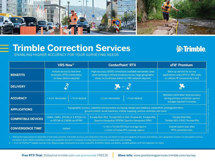
Surveyors in many regions worldwide can now spend less time in the field with CenterPoint RTX® correction service, converging in typically three minutes compared with up to 15 minutes in the past. The breakthrough convergence-time reduction is available on Trimble GNSS receivers with ProPoint™ technology and will benefit land surveyors working around the globe by enabling them to start surveying faster. In addition, CenterPoint RTX now supports the BeiDou-III (BDS-III) constellation, which contributes to convergence time improvements. Support for BDS-III and convergence time improvements is available globally via IP/cellular and regionally via satellite delivery. Convergence times for the CenterPoint RTX Fast regions remain unchanged at less than one minute. CenterPoint RTX Fast coverage is available coast-to-coast in the U.S. and Western Europe.
More Reliable and Robust Performance Worldwide
Geospatial professionals will be able to work more reliably in challenging GNSS environments, such as urban multipath or under tree canopy, due to the addition of BDS-III and GPS III satellite signals into the Trimble RTX solution. Even as GNSS satellites are retired and new ones become operational, users can depend on Trimble RTX to consistently track and deliver corrections that are more robust and reliable than ever before.
Surveyor Workflow Improvements
Using a Trimble receiver with ProPoint technology, Trimble Access™ field software and CenterPoint RTX correction service, surveyors will benefit from a more streamlined workflow that simplifies how they work in their local coordinate systems. Surveyors can now collect data using CenterPoint RTX correction service without the need for a site calibration or an offset.
“Our teams collaborate to continually improve the Trimble RTX-based real-time correction services integration with our geospatial solutions,” said Ron Bisio, senior vice president of Trimble Geospatial. “Surveyors worldwide rely on Trimble to develop products and services that help them get their work done quicker and easier, and this Trimble RTX update is another example of how we continue to deliver surveyors the tools they need to do their jobs even more efficiently.”
“We are celebrating 10 years of providing Trimble RTX-based correction services and each year our services outperform the year before,” said Lisa Wetherbee, general manager of Trimble Advanced Positioning. “We continue to enhance the performance and overall customer experience to help geospatial professionals increase their productivity and provide them peace of mind that our services and people will be there for them around the clock.”
Availability
Trimble RTX subscriptions for Trimble RTX-compatible GNSS receivers are available through Trimble’s Authorized Business Partners or Trimble’s online store at: tpsstore.trimble.com.
About Trimble RTX
Trimble RTX technology utilizes data from a global reference station network to compute high-accuracy positions based on satellite orbit and clock information. Trimble RTX supports a suite of real-time correction services delivering a range of accuracies from better than two centimeters to sub-meter performance in as fast as one minute. Trimble RTX-based positioning services are available via convenient, easy to access satellite delivery or via IP/cellular communication, providing users with flexible options to obtain high-accuracy positions in nearly any work environment. Trimble RTX correction services are available throughout most of the world. For more information, visit: positioningservices.trimble.com.
About Trimble
Trimble is transforming the way the world works by delivering products and services that connect the physical and digital worlds. Core technologies in positioning, modeling, connectivity and data analytics enable customers to improve productivity, quality, safety and sustainability. From purpose-built products to enterprise lifecycle solutions, Trimble software, hardware and services are transforming industries such as agriculture, construction, geospatial and transportation. For more information about Trimble (NASDAQ:TRMB), visit: www.trimble.com.
Also Read –
Trimble MX50 LiDAR System Expands Mobile Mapping Portfolio