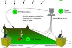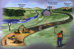
Using the concept of the virtual reference stations, certain systematic errors can be reduced considerably:
1. Ionosphere
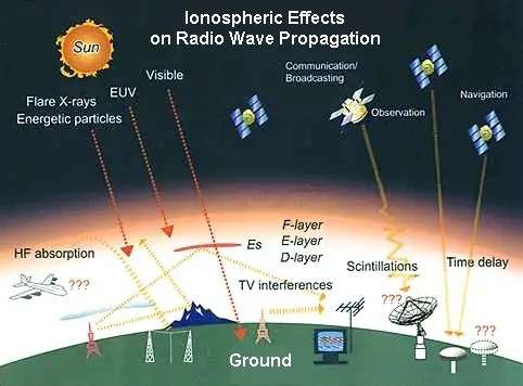
One of the main sources of errors is the Ionosphere . The electrons in the ionosphere are ionized by solar radiation which leads to errors up to 50 m in the GPS observations. The variation of the electron density in the ionosphere depends on the solar cycle which lasts 11 years.
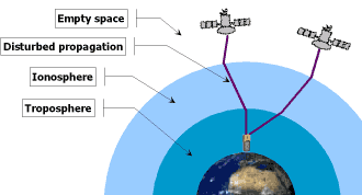
The influence increases with the number of solar spots (a maximum was recorded in 2002) thus making efficient modelling indispensable.
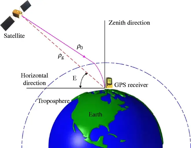
2. Troposphere
The influence of the Troposphere depends on the weather conditions (pressure, temperature, atmospheric humidity , etc). This influence can be corrected with the appropriate models.
3. Satellite Orbits
The influence of the satellite orbits can also be corrected using GPS ephemerides.
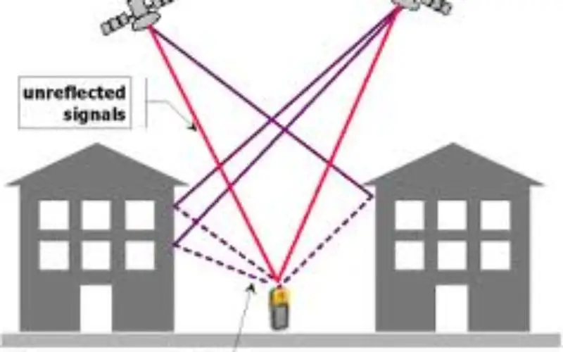
4. Multipath
Multipathing is caused by the direct or indirect reflection of the GPS signals, which distorts positioning. Especially critical are metal surfaces in the vicinity of GPS antennas. It is difficult to correct multipathing using models.

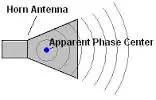
5. Antenna phase center
The Antenna phase center is an approximate calibration value indicated by the software firms. The actual phase center, however, may deviate from these values by several millimeters. In order to obtain precise antenna phase centers, each antenna must be calibrated separately.
Software Solutions for VRS
“GPS-Net” from Trimble Terrasat GmbH. GPS-Net is based on the principle of the virtual reference station. Of the different types of errors mentioned above, special emphasis is placed on the correction of the ionosphere and the satellite orbits. The systematic errors are divided into two groups:
- geometric corrections (troposphere and ephemeride errors)
- ionospheric corrections
Source: Trimble Navigation
Related Topics:
What is Virtual Reference Station?
How Virtual Reference Station Works?
Also Read – Challenges and Benefits of VRS