Trimble Geospatial has recently announced the release of its flagship product Trimble Business Center v5.31 (TBC v5.31). Trimble Business Center is a back-office software enabling surveyors and geospatial professionals to simplify create geospatial data and infrastructure inspection and tunnelling deliverables. TBC is a leading software in its category. TBC software solution provide users with the capability to efficiently edit, process, and adjust geospatial data and create deliverables with confidence.
The latest release features GNSS baseline processing, drafting, point clouds, construction data, and mobile mapping. The highlights are below.
New
features/updates included in TBC v5.31:
Survey
- Baseline processing mode included in report – Now the Baseline Processing Report will have the information of the best mode automatically selected by TBC to process baselines for static GNSS data.
Point Clouds
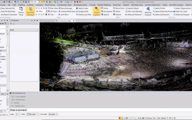
- Faster imports of TDX files – The enhanced TDX importer has capability to do parallel processing, thus making the import process much faster.
- Faster point feature extraction – The enhanced Extract Point Feature command quickly extract point features for trees, poles, and signs. The Extract Point Feature is an Automatic option which is very helpful when extracting large numbers of point features.
Mobile Mapping
- Register Run to Run command enhancements – The enhanced Register Run to Run command now allows the processing of multiple pairs of runs using the new batch mode. Runs from a pair must be from the same mission and have enough overlapping scan data along the trajectory. Once processed, each pair can be inspected as residual RMS or visually using the Cutting Plane and has updated scan Data.
- Faster generation of Mobile Mapping scans in case of zero velocity – Mobile mapping is the process of collecting data from a mobile vehicle. When the vehicle does not move (for example, stopped at a red light), data is still collected. The time required to process data when there is no velocity is faster in TBC 5.31.
- RiMTA dll Upgrade – RiMTA dll has been upgraded to version 6.0, which reduces missing data acquired in tunnels.
Construction Data
- Support for Siteworks Android data structure – When connect to an Android data collector used for Siteworks to TBC, the device is recognized as a controller and does not require connectivity with TBC to work with the files after initial synchronization. This is the same way TBC handles Windows devices.
- Reduce the density of VisionLink data for machine data surfaces – In the Create Machine Data Surface command, you can now reduce the density (e.g., to a 10 m grid rather than the default 0.3m grid) of the data from VisionLink to make surfaces smaller for better performance.
Drafting
- Show volumes on cross-section sheets – When you use the Sheet Set Editor to create/edit cross-section sheets in a sheet set, you can now opt to label the volumes of any materials shown on the sheets. You can also choose the material to report volumes for; the reported/displayed volumes are not adjusted for material densities (shrink/swell/bulkage) or alignment curvature.
- CAD block feature enhancements – You use the CAD block feature in TBC to import or create CAD block definitions from lines, text, and other objects (for example, a north arrow). You can then insert instances of the resulting blocks into your model.
The highlights and details of new features in the TBC v5.30 can be read at – Trimble Business Center (TBC) v5.3 is Now Available, So What’s New in TBC v5.30?
Download TBC v5.31 and learn about new features
You may be interested in – Trimble’s TBC v5.00 Now Available