TatukGIS is pleased to announce the version 5 upgrade of its professional GIS Editor, a desktop GIS data editing and mapping application appropriate for a wide range of users and purposes. Version 5 introduces a host of significant new features and product enhancements, lifting the Editor to the level of the TatukGIS Developer Kernel version 11. Key new features and improvements include:
- Powerful built-in line style editor with unlimited line style possibilities
- 700+ item SVG symbols library, S-57 nautical symbols
- Progressive background rendering vector/raster base map layer(s)
- Streaming TatukGIS hosted worldwide OpenStreetMap tiles
- Redesigned and more intuitive visual layer property controls
- GPU rendering and high resolution 4K monitor support
- OpenCL (GPU) enhanced computation exposed in the API
- Advanced support for pixel operations and grid analysis
- Vector-to-grid interpolation for Kriging, IDW, Splines, and Heatmaps
- Viewshed and Above-Ground-Level (AGL) visibility analysis with OpenCL enhanced computation (script)
- Fresnel zone analysis with OpenCL enhanced computation (script)
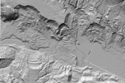
- Slope analysis (script)
- Enhancements to the scripting API making it more comprehensive than ever before
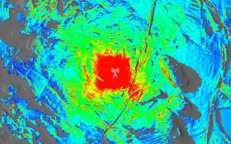
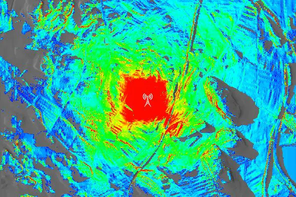
Color ramped presentation of viewshed frequency analysis from four radio antennas.
Redesigned and greatly enhanced support for pixel operations, in combination with the Editor’s built-in scripting IDE, opens the door to powerful new raster analysis possibilities. The Viewshed, AGL visibility, Fresnel zone, and slope analysis features provided so far are just the beginning. The scripting environment exposes within the Editor the full TatukGIS object API, giving power users the means to add their own custom features and functionality. With its 750 classes and 19,000 documented methods and properties, the TatukGIS API is extensive and powerful. The API exposes new support for OpenCL (GPU) enhanced computation for top performance in situations involving repetitive calculations.
TatukGIS also announces version 5 of its free desktop GIS Viewer product. The Viewer is the same as the Editor except for omitted features. Both applications are developed from the TatukGIS Developer Kernel (GIS SDK).
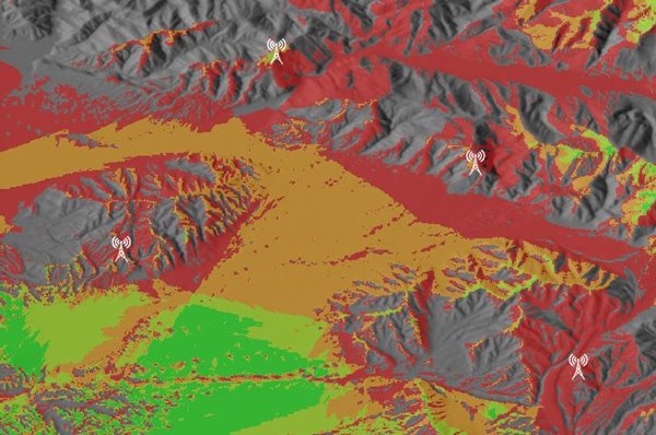
Fresnel zone radio wave propagation analysis considering antenna height and wave frequency.
The Editor 5 is available for download from the TatukGIS web site – the retail version for customers with active maintenance plan and a new trial version for evaluators. The TatukGIS Viewer 5 is available for download and use free of any license fee, per terms of the license agreement.
Read more about the TatukGIS Editor and free Viewer products at: https://www.tatukgis.com/products/editorviewer