Sentinel-3B, 7th Satellite of the Copernicus Programme Launched Successfully
- On 25 April 2018 at 19:57 CEST, the Earth observation satellite Sentinel-3B lifted off on a Rockot launcher from the Russian cosmodrome in Plesetsk
- With Sentinel-3B, the seventh satellite of the Copernicus programme has been launched and the first four satellite missions of the Copernicus space segment are now complete
- The oceans are the focus of the mission, but large-scale changes in land areas will also be recorded
- Focus: Big Data, space
April 25, 2018 – The Sentinel-3 satellite pair, one of the principal components of the European Copernicus programme,
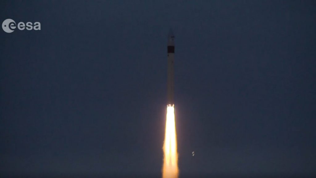
Launch of Sentinel-3B
Optimised orbit allows additional ocean observations
Sentinel-3B is now orbiting Earth at an altitude of approximately 815 kilometres, in the same polar orbit as its identical twin, Sentinel-3A, which was launched in February 2016. At the start of their joint mission, the satellites are flying in tandem, just 30 seconds apart, to calibrate their many sensors. Later, they will move apart, to a separation of about 40 minutes, to ensure the best temporal coverage of Earth’s surface. Based on the findings obtained with Sentinel-3A, the orbit of Sentinel-3B was optimised to allow more frequent measurements of sea level. The satellite will send data to Earth for at least seven years. The oceans are the focus of the mission, but large-scale changes in land areas will also be recorded.
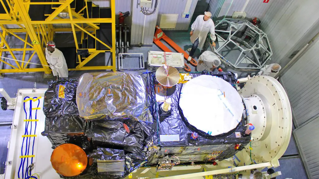
Inspection of Sentinel-3B
Oceans store and transport heat
The water masses on Earth, which cover about 70 percent of the planet’s surface, store and transport large amounts of energy and heat. As a result, they have a strong influence on Earth’s climate and weather systems. The extensive data on water temperature, sea level and ocean ice thickness, which the two identical Sentinel-3 satellites will transmit in near real time, are therefore of interest to more than just the maritime transport industry. Most importantly, they provide the basis for accurate weather forecasting and climate research – for example, to produce models of climate change that are as realistic as possible. In addition, the data allow monitoring of marine pollution and the amount of biomass produced in the oceans.
Over land, the Sentinel-3 mission aims to detect active forest fires and burnt areas in order to assess carbon emissions, but also to provide large-scale information on disaster risks. In addition, the satellites will investigate different types of land use and the state of vegetation on Earth’s surface. These data will be used for the creation of maps as well as in modern agricultural management. Other tasks for the twin satellites include, for example, the detection of what are referred to as heat islands – that is, localised temperature increases that occur over large cities. Their influence on the regional climate and the impact of climate change on these cities are still largely unexplored.
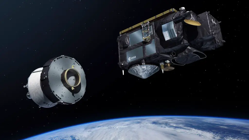
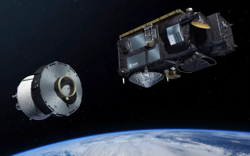
Artist’s view. Sentinel-3 separates from the upper stage of the launch vehicle.
DLR is an important partner in the ground segment
Three Processing and Archiving Centres (PACs) receive, process and store Sentinal-3 data. One of them is DLR’s Earth Observation Center (EOC) in Oberpfaffenhofen. The raw data received by the ground station in Svalbard, Norway, reaches the site via the Copernicus high-performance data network. Here, information products are created and made accessible to scientific users and the public in the long-term archive. The first test data is expected a few days after the satellite launch. Calibrated and corrected data is expected to be available in September.
The Sentinel-3B data will continue to expand the Copernicus database in the German Satellite Data Archive (Deutschen Satellitendatenarchiv; DSDA). Together with the data from the Sentinel-1 radar mission, over 3.6 million data sets and a data volume of more than 7200 terabytes (7.1 petabytes) have been stored in just three-and-a-half years. Burned onto CDs, this would create a tower around 1800 metres high – five-and-a-half times the height of the Eiffel Tower. “Processing and analysing this vast amount of data is the new challenge for Earth observation. Thanks to our many years of experience in handling enormous amounts of data – for example, in the context of the TanDEM-X mission – we are now able to use our methods to carry out Big Data analyses in Earth observation,” says Stefan Dech, one of the two directors of the EOC.
With the launch of Sentinel-3B, the Copernicus programme’s seventh satellite is in orbit and the first four satellite missions of the Copernicus space segment are now complete. In addition to Sentinel-3, these include Sentinel-1’s two radar satellites – which observe Earth day and night and through cloud cover – Sentinel-2A and -2B, which focus on landmasses, and Sentinel-5P for measuring air pollutants, greenhouse gases and aerosols. The next launch of a Copernicus satellite is scheduled for 2020.
Sentinel-3 – a European cooperation
The Sentinel-3 mission is part of the Copernicus programme, a partnership between the European Union (EU) and ESA. Following the commissioning of the satellites in orbit, the mission will be jointly conducted by ESA and the European Organisation for the Exploitation of Meteorological Satellites (EUMETSAT) on behalf of the EU. ESA is responsible for creating data products for land surfaces, while EUMETSAT provides the ocean and atmospheric products. The two Sentinel-3 satellites were built by a consortium of approximately 100 European companies under the leadership of Thales Alenia Space (France). The DLR Space Administration manages the German contributions to the programme on behalf of the Federal Ministry of Transport and Digital Infrastructure (Bundesministerium für Verkehr und digitale Infrastruktur; BMVI) and the Federal Ministry for Economic Affairs and Energy (Bundesministerium für Wirtschaft und Energie; BMWi).
Source: DLR