Hyperspectral Instrument DESIS En Route to International Space Station in 2018
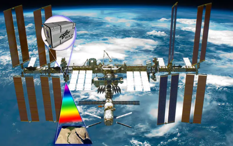
- The DLR Earth Sensing Imaging Spectrometer (DESIS) environment and resource monitoring system will launch to the ISS in the summer of 2018
- The hyperspectral sensor system has a spatial resolution of 30 metres
- DLR and the US company Teledyne Brown Engineering (TBE) cooperated on the development of the instrument
- Focus: Environment monitoring, Earth observation, space, ISS
The German Aerospace Center (Deutsches Zentrum für Luft- und Raumfahrt; DLR) and the United States corporation Teledyne Brown Engineering (TBE) are
Hundreds of spectral channels for environmental monitoring
DESIS will be DLR’s first instrument for the analysis of hyperspectral data on the ISS. “Hyperspectral sensing of Earth’s surface is crucial for environmental monitoring,” summarises Pascale Ehrenfreund, Chair of the DLR Executive Board. “The continuous coverage of the Visible Near Infrared (VNIR) spectral range makes DESIS a multi-purpose instrument, which will help to gain new knowledge about agriculture, biodiversity, geology and mineralogy, coastal zones, water ecosystems, desertification and to detect changes in general.”
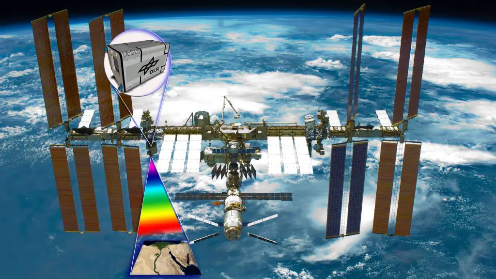
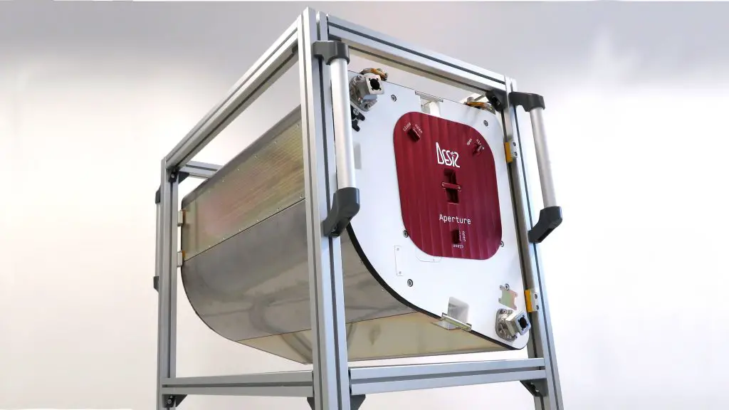
DESIS – hyperspectral Earth observation instrument on the ISS
DESIS is a hyperspectral sensor system with the capability of recording image data using 235 closely arranged channels ranging from the visual to the infrared spectrum (between 400 and 1000 nanometres) with a geometrical surface resolution of 30 metres while in ISS orbit, at an altitude of 400 kilometres. This data enables researchers to detect changes in the ecosystem of Earth’s surface to assess the status of forests or agricultural areas, and therefore make yield predictions. Thus, one of the tasks of DESIS is to secure and improve global food cultivation.
The spectral bands recorded by DESIS are also ideal for determining the quality of water, in particular of oceans and lakes. With the data, researchers are not only able to determine water composition and pollutants, but can also identify the causes of the contamination. Oil spills can be measured in their extent and also in their thickness. The water content of soil can also be analysed using DESIS data. DESIS will be installed on the multi-platform MUSES, which can host up to four Earth observation instruments at the same time using the Canadian robotic arm (Canadarm2) on the ISS. The platform was designed, developed and built by Teledyne Brown Engineering. The instruments are mechanically locked in place and have a separate power supply. This configuration makes the International Space Station a universal instrument platform for Earth observation that also enables replacement, repair and maintenance. Due to the nature of this mission, it will also be possible to bring the instrument back to Earth after its operational life of five to eight years, in order to examine the effects of exposure to space conditions.
Hyperspectral sensor system
High-efficiency gain through cooperation with Teledyne Brown and utilisation of the ISS
“The mere fact that we did not have to build an entire satellite around the DESIS instrument makes it a very cost-effective project,” says Uwe Knodt, programme manager of DESIS. While DLR is responsible for the construction of the instrument and the subsequent image data processing, Teledyne Brown and NASA are responsible for transport to the ISS and ensuring operations. Both organisations can greatly benefit from one another. While TBD has the commercial licence to use the image data, DLR provides expert imaging processing algorithms through licence payments and will retain the legal right to use the data for scientific applications. The use of MUSES and the ISS as an imaging platform allow instruments to be ready and operational in a very short period of time providing vital data to assist in scientific, humanitarian and commercial missions.
“Teledyne Brown Engineering is thrilled with the progress achieved through the partnership with DLR,” stated Jan Hess, President of TBE. “Our MUSES platform coupled with the DESIS and other instruments will assist in the advancement of Earth imaging, mapping, disaster recovery and agricultural assessments. Our goal is to quickly populate each slot aboard MUSES to allow for maximum coverage and data collection.” This cooperation has had a fundamental impact on the development of DESIS. The entire planning and manufacturing process took just three and a half years – an almost record-breaking achievement considering such a modern instrument designed for low-Earth orbit.
Together, DESIS and MUSES can look forward, backward and sideways from the ISS. This high degree of agility makes it possible to promptly provide information for relief organisations in the event of a disaster. Collaboration in this type of scientific and commercial operation is critical to the future prospects of hyperspectral remote sensing technologies for satellite missions. DLR and TBE want to leverage the data of DESIS and future MUSES instruments to further improve Earth observation and to expand the use of hyperspectral sensing in commercial applications.
Cooperating within this scientific and commercial framework will also contribute to hyperspectral remote sensing technologies on satellite missions in the future. Research within these fields of expertise will greatly benefit from the use of DESIS.
Source: DLR