The changing environment and unprecedented changes in seasons have been an issue for a long time. The increase in greenhouse gases has resulted in an increase in temperature during the summer seasons. This has caused tremendous effects on forest cover of our planet.
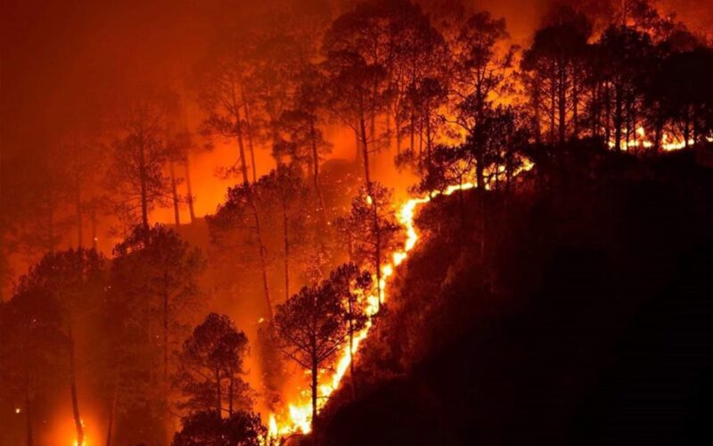
In the past few years, we have seen an increase in wildfires. Wildfire is a fire that starts, usually by itself, in a wild area such as a forest, and spreads rapidly, causing great damage. Wildfires are a great threat to our flora-fauna.
To support the effective near real-time mapping and to help firefighters to contain wildfires, Google
How Google is Using Satellite Imagery for Mapping Wildfires?
Data Processing
Google Earth Engine is at the core of processing satellite imagery for mapping wildfire. Google Earth Engine is a tool for analyzing geospatial information. One can analyze forest and water coverage, land-use change, or assess the health of agricultural fields, among many other possible analyses.
Google Earth Engine combines a multi-petabyte catalog of satellite imagery and geospatial datasets with planetary-scale analysis capabilities and makes it available for scientists, researchers, and developers to detect changes, map trends, and quantify differences on the Earth’s surface.
Google Earth Engine provides client libraries for JavaScript and Python to translate complex geospatial analyses to Earth Engine requests. REST APIs are also available to connect directly to Earth Engine servers.
Google works closely with the National Oceanic and Atmospheric Administration’s (NOAA) to acquire satellite data of GOES constellation of satellites. The satellites are on-board with sensors operating in wavelengths ranging from visible to infrared (IR). This allows the identification of smoke, burned areas, and active fires.
The satellite images then processed using Google Earth Engine processing libraries for data analysis. Analysis of satellite data provides the size of a wildfire in near real-time, with data being refreshed roughly every hour.

Significant research and improved fire detection algorithms has enhanced the capability of accurate detection and mapping of wildfires.
Information Presentation
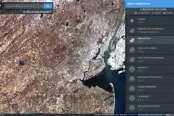
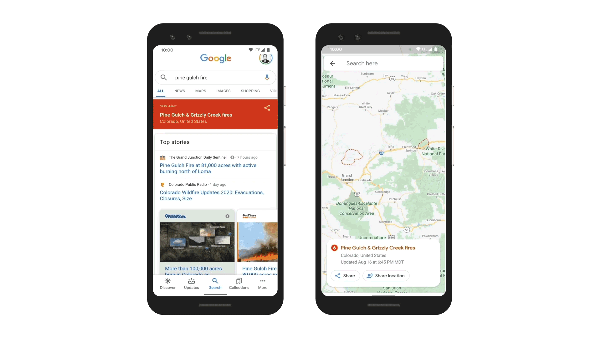
After identification of pixels corresponding to wildfire, a digital polygon is created with a red boundary shown on the map in Search and Google Maps. The red boundary represents an approximate wildfire impact area. If multiple large fires are active in the same region, people may see several polygons.
Information Sharing
In the year 2017, Google has started helping people by SOS alerts about wildfires. Since then Google has evolved a lot. Today, Google Search provides more accurate information and connect people with high-quality information during crises.
Now, Google can send SOS alerts, with the latest boundary map, on Google Search results and Google Maps.
Last year, Google collaborated with organizations, like the California Governor’s Office of Emergency Services (Cal OES) and Boulder’s Office of Emergency Management to collect subject matter expert guidance and recommendations on preparedness and response.
This lead to a pilot project, to help explore and ensure the Google Search feature for major California wildfires. The tool was useful for first responders, emergency management personnel, and the community.
To learn more the complete workflow on analyzing and visualizing wildfire data from satellites read a detailed blog post. The blog post also shares the code-snippet used in the workflow.
You may aslo be interested in –