GIS-powered Vector Mosquito Data Management System to Enhance Public Health
 In warm and humid subtropical areas like Southeast Asia, prevention and cure of vector mosquito is a key mission for epidemic and diseases control authorities. To achieve the goal, officers need to establish a system, which should be easy-to-use but also capable to load large data and display it in an understandable way.
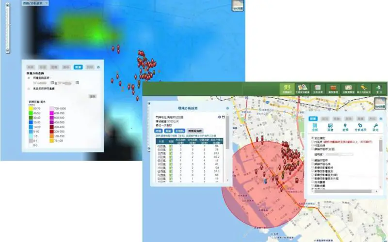
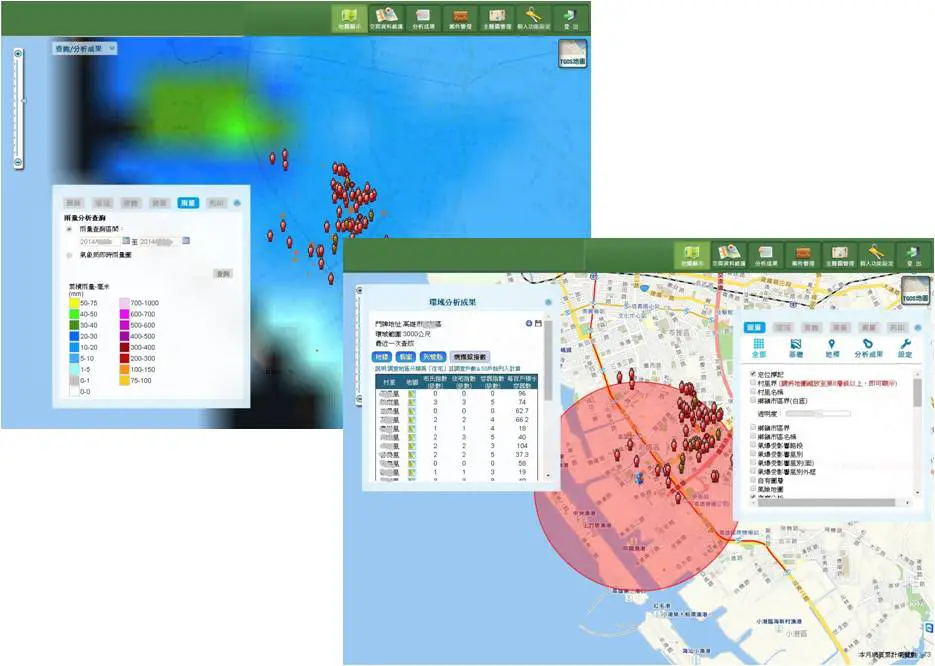
The authority in Taiwan built the Vector Mosquito Data Management System, based on SuperGIS Server 3 and SuperGIS Server Spatial Statistical Analyst to present time-space analyses on maps. The system integrates regional field survey, instant data reporting and other massive relevant references, like real-time rainfall data from Central Weather Bureau.
To predict potential infectious route, officers perform buffer analysis, import rainfall data, and overlay them on road maps to see if there are any specific region needs to take actions right away. Also, the system can list the cases with population information like names, gender, age, and the occurrence date of certain epidemic, etc., so that they can well follow up and control each case, and trace it on the map for effective health management.
The working procedure and solution are as the following:
- Adopting SuperGIS Server as the Core System.
- Providing Intuitive and Simple Interface and Workflow.
- Querying and Analyzing Data with Time, Space and Relevant Conditions.
- Integrating Meteorological Data with Map Service.
- Plotting Relation Graphs According to Time-Space Relevance of Each Infected Case.
The epidemic control authority utilizes GIS technologies to visualize diverse data providing officers with mass useful information. As the growth of vector mosquito and infection of diseases are highly related with space, the application of GIS can assist officers to predict and make better decision in advance.
Learn more about the case : http://www.supergeotek.com/Library_2_201409.aspx
Get trial of SuperGIS Server 3.2: http://www.supergeotek.com/download_6_server.aspx
# # #
About Supergeo
Supergeo Technologies Inc. is a leading global provider of GIS software and solutions. Since the establishment, Supergeo has been dedicated to providing state-of-the-art geospatial technologies and comprehensive services for customers around the world. It is our vision to help users utilize geospatial technologies to create a better world.
Supergeo software and applications have been spread over the world to be the backbone of the world’s mapping and spatial analysis. Supergeo is the professional GIS vendor, providing GIS-related users with complete GIS solutions for desktop, mobile, server, and Internet platforms.
Marketing Contact:
Patty Chen
Supergeo Technologies Inc.
5F, No. 71, Sec. 1, Zhouzi St., Taipei, 114, TAIWAN
TEL:+886-2-2659 1899
Website: http://www.supergeotek.com
Email: patty@supergeotek.com