In recent news, GAGAN-GPS Aided Geo Augmented Navigation System will become fully operational in month of February this year as conformed by S. V. Satish, GM-Air Traffic Management, Gagan project, Airports Authority of India (AAI).
The GAGAN System, jointly developed by the Indian Space Research Organisation (ISRO) and Airports Authority of India (AAI), is a giant leap forward in the development of Global Navigation Satellite System (GNSS) services in India and will pave the way for more growth and enhancement in the days to come. GAGAN will help to gain a accuracy of 1.5 m in horizontal and 2.5 m in vertical.
“We will remove the code that has been set for the last one year to use Gagan on a test basis so that anyone with a receiver and access to the application can use the satellite-based navigation system,” said S. V. Satish
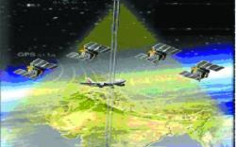
Aircraft manufacturers have already been given the platform to receive signals from Gagan in the Satellite Based Augmented System (SBAS) receiver. The GAGAN signal is being broadcast through two Geostationary Earth Orbit (GEO) satellites – GSAT8 and GSAT10 – covering whole Indian Flight Information Region (FIR) and beyond. An on-orbit spare GAGAN transponder will be flown on GSAT-15.
India is the fourth country to offer safety of life, space based satellite navigation services to aviation sector in the world.
S. V. Satish said:
“A little improvement to the present GPS system is enough to receive signals from Gagan,” , adding that the cost of the basic receiver chip starts at $10, the complete receiver system working out to $3000.
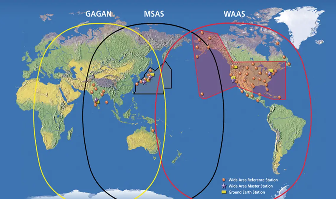
Satellite Based Augmentation System (SBAS)
Recently the Directorate General of Civil Aviation (DGCA), India has provisionally certified the ambitious Satellite Based Augmentation System (SBAS) programme of India – GPS Aided Geo Augmented Navigation (GAGAN) system – to RNP0.1 (Required Navigation Performance, 0.1 Nautical Mile) service level on December 30, 2013. The certification will enable the aircraft fitted with SBAS equipment to use GAGAN signal in space for En-Route Navigation and Non-Precision Approaches without vertical guidance over Indian air space.
Read more about GAGAN
Source: Deccan Cronicle