Contour Connection Method: an automated Method for Landslide Identification with LiDAR
In a study by Ben A. Leshchinsky et. al., from Oregon State University has developed a new algorithm “Contour Connection Method” for automated landslide deposits from LiDAR data.
Landslide is a geological phenomenon, also known as landslip includes a wide range of ground movements results in the downward and outward movements of slope forming materials such as rocks, soil, etc..They result from the failure of the materials which make up the hill slope and are driven by the force of gravity. Landslides can be triggered by natural causes or by human activity. They range from a single boulder in a rock fall or topple to tens of millions of cubic meters of material in a debris flow.
Credit: NASA
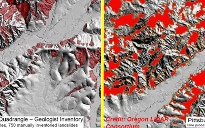
The current landslide mapping techniques include field visits for data inventory (often the regions at highest risk of recurrence) and photogrammetric, remote sensing or LiDAR techniques to derive bare earth Digital Terrain Model (DTM) to highlight regions of instability. However, many techniques do not have sufficient resolution, detail, and accuracy for mapping across landscape scale with the exception of using BE DTMs, which can reveal the landscape beneath vegetation and other obstructions, highlighting landslide features, including scarps, deposits, fans and more.
The new algorithm named as Contour Connection Method (CCM) is primarily based on bare earth LiDAR data requiring minimal user input and focuses on general landslide characteristics such as the landslide scarp and deposit gradients. This algorithm automatically and consistently detects landslide deposits on a landscape.
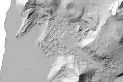
The Contour Connection Method (CCM) is primarily based on bare earth LiDAR data. The Contour Connection Method (CCM) algorithm functions by applying contours and nodes to a map, and using vectors connecting the nodes to evaluate gradient and associated landslide features based on the user defined input criteria.
The algorithm not only identifies landslide but also provide unique signature to each landslide for classification of classify different landscape features. This is possible because each landslide feature has a distinct set of metadata – specifically, density of connection vectors on each contour – that provides a unique signature for each landslide.
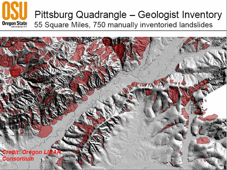
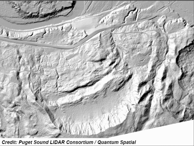
In the paper by Ben A. Leshchinsky et. al “Contour Connection Method for automated identification and classification of landslide deposits”, demonstrate the use of CCM algorithm to the region surrounding the Oso landslide in Washington (March 2014), as well as two 14,000 ha DTMs in Oregon, which were used as a comparison of CCM and manually delineated landslide deposits.
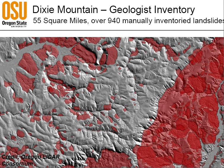
The results show the capability of the CCM with limited data requirements and the agreement with manual delineation but achieving the results at a much faster time. This presents a promising tool for a consistent means of inventorying existing landslides.