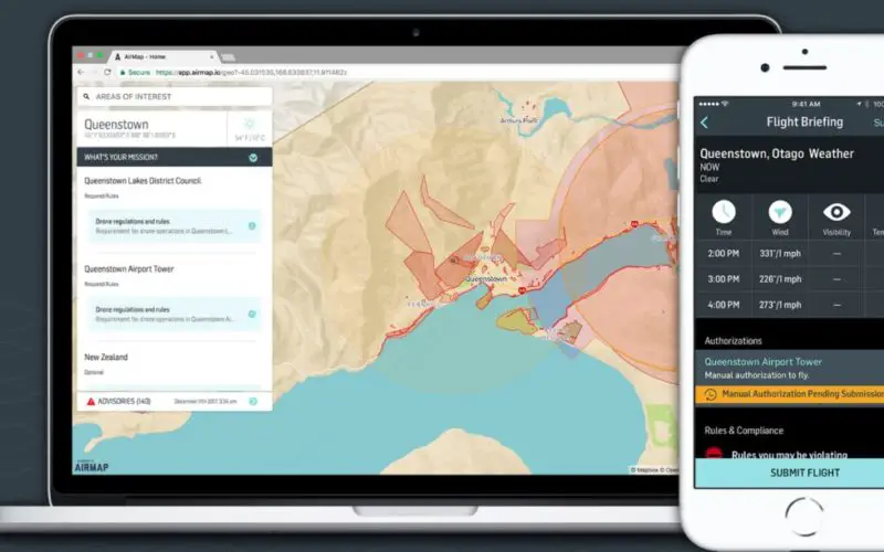
December 12th, 2017 – Big news for Kiwi drone pilots: we’ve joined forces with Airways to bring digital airspace authorization to New Zealand’s drone community.
Beginning today, drone operators can use AirMap’s iOS and Android apps to request airspace approvals required by New Zealand’s Civil Aviation Authority at Christchurch, Queenstown, and Wanaka airports, and on public lands in the Christchurch City, Selwyn, and Queenstown Lakes District Council, including parks and reserves.
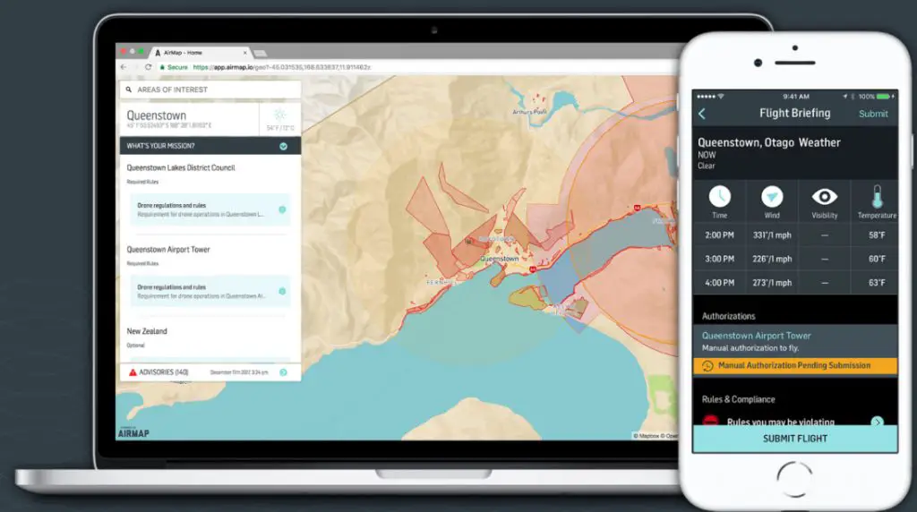
During the three-month trial, participating locations will use the AirMap airspace management dashboard to approve flight plans and share real-time updates with drone operators about the location of events, community gatherings, emergencies, and more. This information is published immediately to the AirMap platform so that drone operators can plan safer flights and stay up-to-date on changing airspace conditions before and during their missions.
Drones are already contributing to New Zealand’s economy, assisting rescue and recovery missions and taking on inspections for public utilities, construction sites, and more. Drone flights in the country’s controlled airspace have increased 20x over the past three years, and 2018 is expected to be another banner year for New Zealand’s drone ecosystem.
In Switzerland, Kansas, Japan, and now New Zealand, AirMap is opening the airspace for commercial drones with industry-leading UTM technology. If you’re taking off in New Zealand, we hope you’ll take part in the trial by downloading AirMap’s iOS or Android apps. You can learn more about the trial here.
Source: AirMap