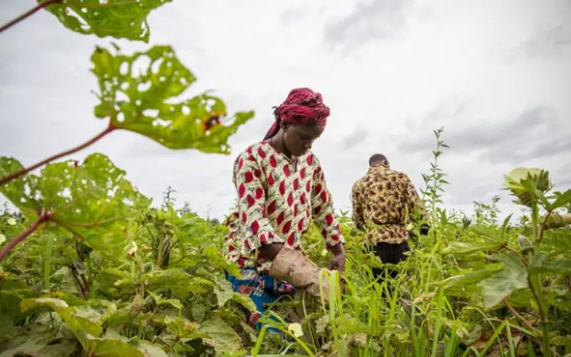
Most will be aware of the recent crisis that hit the Agriculture sector wherein despite a scenario of plentiful produce the individual farmer was in acute distress. Sound agricultural practices entail the use of good quality disease-resistant seeds sown in good quality soil, the use of appropriate soil nutrients and pesticides and the availability of water amongst others. Under such salubrious conditions, the crop would be bountiful and both the farmer and the consumer go back happy to continue the cycle.
However, sustainable agriculture development goes beyond increasing the quantity of agricultural produce and sustaining that increase for the near future. As was seen, the farmer was not happy with the money he was getting for his bountiful produce. On the other hand, the consumer was happy that the prices of vegetables had fallen and had become affordable. Thereafter the converse happened. The prices of certain vegetables suddenly shot up leaving a big hole in the consumers pocket without any benefit to the farmer.
A central objective of sustainable agriculture development is to ensure social inclusion. To enable all stake holders to optimise the returns from the efforts & investments made in agriculture, it becomes important to monitor crop quantity with other socio-economic indicators such as crop acreage, soil type, crop type, crop yield, socio-economic status, geography, gender, age, transportation facility, storage facility, a fair return on investment, market trends and other dimensions in order to track and address marginalization and inequalities across sub-populations.
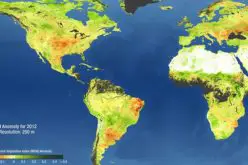
New Geospatial technologies & tools, such as, GIS, remote sensing, social networking, mobile phones, crowdsourcing, etc. would give capabilities to provide ‘Decision Support Scenarios’ which would be vital to monitor the overall health of the Agricultural sector. Embedded within the GIS would be a robust MIS that incorporates the above mentioned and other factors as ‘national indicators’ to be maintained on a regional and national basis. Models can be generated from the aggregated data to produce food supply & demand projections. Refinements in the models would be required over time depending on data quality and assumptions made for the model scenarios. This would go a long way in mitigating the causes for the farmer crisis that occurred recently.
Many of the actual solutions will need to be implemented at the state and district levels, all the way down to the household, farm, field and even within-field scales where changes in behaviour as well as farming technologies, such as, precision farming, modern low‐pressure drip or other micro-irrigation systems etc, will be a critical condition for success.
India is on route to create an Agricultural Market Information System (AMIS). Incorporating Geospatial technologies into this system would improve basic socio-economic & crop statistics for the overall management of crops, training, education and crop & consumption demand & supply. It would also enable an equitable distribution of crop insurance due to more accurate crop forecasts and more precise assessment of crop damage due to disease, natural disasters such as drought & flood etc.
The issue – September 2017 of the magazine attempts to give balanced information on the research and practical aspects of the application of Geospatial technology for Sustainable Agriculture Development. It is hoped that readers will use the information to get a better understanding of the issues involved. This is also an attempt to engage the stakeholders in an exchange of technology and information.