
Each object has its own spectral signature, which is also the basic principle of remote sensing. Today we have satellites with various sensors collecting data in Visible light, Near Infrared (NIR), Thermal Infrared (TIR), Panchromatic and Shortwave Infrared (SWIR ).
If we have these many sensors, why SWIR band sensor?
SWIR is immediately adjacent to NIR in the electromagnetic spectrum and refers to non-visible light falling roughly between 1400 and 3000 nanometers (nm) in wavelength.
SWIR Sensor vs Visible Light Sensor:
SWIR light is reflective in nature and bounces off objects much like visible light. But SWIR light is not visible to human eyes. As a result of its reflective nature, SWIR light has shadow and contrast in its imagery (contrast depends upon the radiometric resolution of the sensor). Unlike visible light imagery SWIR light image is not in color. This makes objects easily recognizable and yields one of the tactical advantages of the SWIR, namely, object or individual identification.

Visible blue, green, and red of Landsat 8 satellite. Credit: USGS
SWIR Sensor vs Thermal Sensor:
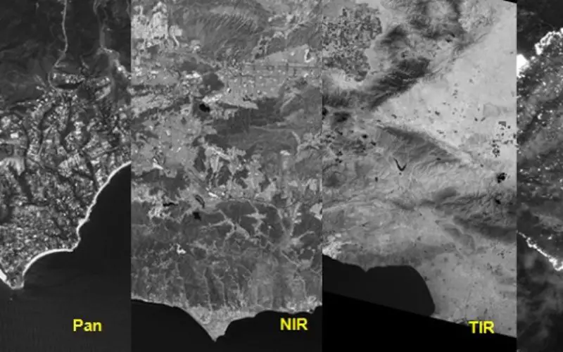
Thermal sensors are another important type of sensor as they can see heat and so are used for thermal mapping. Instead of measuring the temperature of the air (as weather stations do), they capture the ground heat. Thermal sensors capture imagery of warm objects against a cool background and they do not provide good resolution (100 m in Landsat 8) imagery. Whereas SWIR sensors can have high resolution (30 m in Landsat 8, 3.7/7.5 meter in WorldView 3) and can actually identify what an object is. They also pinpoint sites of active burning, detect hot spots and estimate of where the fire is burning the hottest so that response efforts can be directed most efficiently.
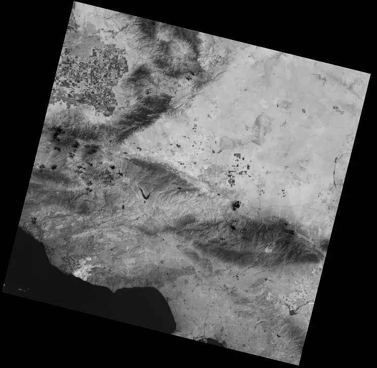
Thermal infrared, or TIR bands of Landsat 8 satellite. Credit: USGS
Like SWIR light imagery they are also not in color. SWIR Sensors are smaller in size than Thermal sensor, hence a lighter payload for satellites.
SWIR Sensor vs Panchromatic Sensor:
Panchromatic sensors capture imagery in a single band (black and white film) instead of collecting visible color (red, green, blue) separately, it combines them into one channel or band. The panchromatic sensor can see more light at once and can have very high spatial resolutions (31 cm in WorldView 3) than any other sensor type. However panchromatic sensors can not see at night and through smoke.

Panchromatic band of Landsat 8 satellite . Credi: USGS
SWIR sensor may not have similar spatial resolution but they have a high spatial resolution (3.7/7.5 meter in WorldView 3, 30 m in Landsat 8). SWIR sensor can be seen at night and through smoke.
SWIR Sensor vs NIR Sensor:
Near-infrared sensor are extremely important for ecology because healthy plants reflect it – the water in their leaves scatters the wavelengths back into the sky. They can be used for vegetation monitoring, crop stress etc. By comparing it with other bands, we get indexes like NDVI, which let us measure plant health more precisely than if we only looked at visible greenness. But NIR sensor do not tell us about the geology, rocks etc.
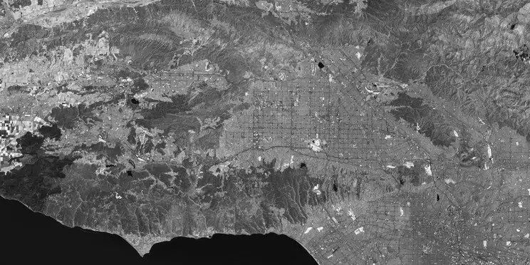
Near infrared, or NIR of Landsat 8 satellite. Credit: USGS
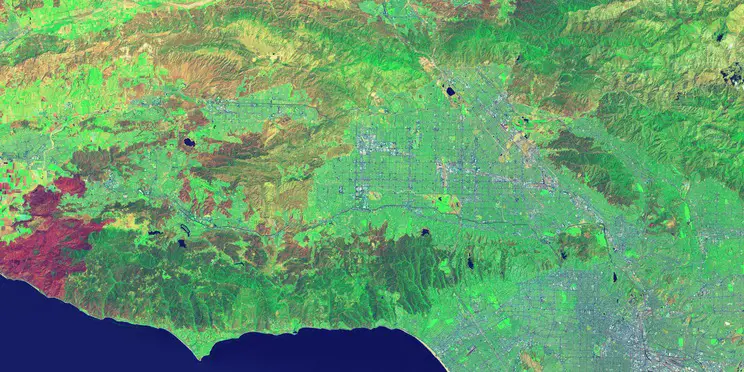
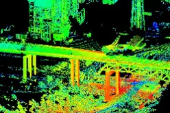
False-color image by using SWIR as red, NIR as green, and deep blue as blue of Landsat 8 satellite. Credit: USGS
SWIR sensors are particularly useful for telling wet earth from dry earth, and for geology: rocks and soils that look similar in other bands often have strong contrasts in SWIR. SWIR sensors discriminate the moisture content of soil and vegetation and penetrate thin clouds.

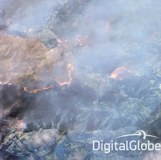
I. The SWIR image is a “false color” composite made from three of the eight SWIR bands (bands 6, 3, and 1) that coincidentally give an orange color to the fire. Credit: DigitalGlobe
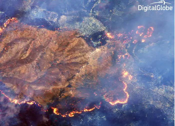
II. The SWIR bands penetrate smoke to differing degrees. SWIR band 8 has the best smoke penetration. Credit: DigitalGlobe
III. Further zoom around the burn area in which no smoke is visible. Credit: Digitalglobe
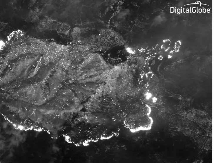
IV. SWIR band 8 has the best smoke penetration; here is a zoomed-in shot of the fire line in which no smoke is visible. Credit: DigitalGlobe
Possible Applications of SWIR Sensors:
- Mineral exploration
- Wildfire response (can penetrate through smoke)
- Food security
- Mining/Geology
- Urban feature identification (such as roofing and construction materials)
- Vegetation
- Petroleum (e.g. an oil spill)
- Snow and Ice discrimination
- Soil moisture estimation
Advantages of SWIR
- High sensitivity
- High resolution
- Provide imagery in day and night
- Can see penetrated thin clouds
- Covert illumination
- SWIR sensors are small in size, hence lighter payload and can be mounted on UAV
- Can see through the smoke
- Atmospheric aerosols have a lesser effect on SWIR bands.


It a new news for working coulture