A traffic collision, also known as a traffic accident, motor vehicle collision, motor vehicle accident, car accident, automobile accident, road traffic collision, road traffic accident, wreck(USA), car crash, or car smash (Australian) occurs when a vehicle collides with another vehicle, pedestrian, animal, road debris, or other stationary obstruction, such as a tree or utility pole. Traffic collisions may result in injury, death, vehicle damage, and property damage.
A number of factors contribute to the risk of collision, including vehicle design, speed of operation, road design, road environment, driver skill and/or impairment, and driver behaviour. Worldwide, motor vehicle collisions lead to death and disability as well as financial costs to both society and the individuals involved.
A 1985 study by K. Rumar, using British and American crash reports as data, found that 57% of crashes were due solely to driver factors, 27% to combined roadway and driver factors, 6% to combined vehicle and driver factors, 3% solely to roadway factors, 3% to combined roadway, driver, and vehicle factors, 2% solely to vehicle factors, and 1% to combined roadway and vehicle factors.
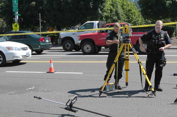
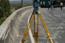
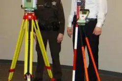
Investigation of traffic collision is quite a challenging task for investigators across the world. Introduction of new technological tools (total station) are truly effective in documentation of crash and crime scenes along with solid forensic training and skills of investigation team.
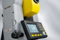
The Nye County, Nevada, Sheriff’s Office is one of the first in the state to pursue technology for its mostly crash investigations. Leading this effort is Sheriff Tony DeMeo, who over-sees 70 deputies covering his office’s sprawling northern and southern commands of Nevada. He uses two Sokkia SET550RX total stations, and the Crash Zone and Crime Zone diagramming software from The CAD Zone, Inc., which enables him to produce two and three dimensional diagrams. Sheriff DeMeo was able to purchase his two total stations, which he personally specified after learning Sokkia was frequently used brand in crash investigations, and the diagramming software with PETT funds or Payments Equal to Taxes paid to Nye County for the Yucca Mountain Nuclear Waste Repository Project.
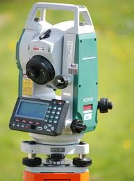
The Sokkia SET550RX total stations were chosen for several valuable capabilities: enhanced environmental durability, including extreme heat and cold, the finest powder dust, and the hardest driving rain; measurement range of 1,310 feet; display of crash scene measurement results within 1.7 to 4.2 seconds under any circumstance; and a narrow red EDM (electronic distance meter) beam for pinpoint reflectorless measurement.
The total stations and drawing software are used mostly for serious injury and fatal accidents. Because of the severity and scope of these scenes, Sheriff DeMeo often will overlay mapped scenes on top of aerial images of them provided by Google Earth. “We do this often because it is evidence that will be used in court,” the sheriff said. “And people in court can see exactly where an accident occured.” Another benefit is that layers of the scene can be created with The Crash Zone software and pulled out for observation and analysis as needed. The layers show specific sections or details of a crash scene.
Livingston County’s Traffic Safety Bureau will be getting a new piece of equipment called the Leica TS12 total station, which is a piece of highly sophisticated equipment that can electronically measure and record serious injury and fatal traffic crashes along with crime scenes. Commissioner Dave Domas says it provides a more accurate report of crash and crime scene events and allows information to be stored digitally for almost an unlimited period of time.
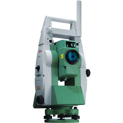
The one currently owned by the Sheriff’s Department is almost twelve years old and requires two person operations so the new equipment will allow for a more thorough evidence collection and investigation in less time and help to reduce overtime costs but also limit road closure times at crash scenes.
Sources: