Earth on AWS: Large Geospatial Datasets Available on the Amazon Web Services

Credit: Amazon
Amazon Web Services (AWS) had launched the Landsat on AWS in the year of 2015, a Public Dataset made up of imagery from the Landsat 8 satellite.
On September 16, 2016 (AWS Blog), AWS has launched Earth on AWS and making more large geospatial datasets openly available in the cloud so you can bring your algorithms to the data instead of being required to download them to your machine locally. But more than just making the data openly available, the Earth on AWS initiative will focus on providing resources to help you understand how to work with the data. We are also announcing an associated Call for Proposals for research utilizing the Earth on AWS datasets.
Earth on AWS currently contains the following data sets:
NAIP 1m Imagery: The National Agriculture Imagery Program (NAIP) acquires aerial imagery during the agricultural growing seasons in the continental 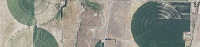 U.S. This “leaf-on” imagery is approximately 1 meter in resolution and is available on Amazon S3 as 4-band RGB + NIR GeoTIFFs and RGB JPEGs. NAIP data is delivered at the state level and every year a number of states receive updates with an overall update cycle of three years.
NAIP is administered by the U.S. Department of Agriculture’s Farm Service Agency (FSA) through the Aerial Photography Field Office (APFO) in Salt Lake City. Data is available ranging from 2012 to 2015, with some states having 3 years of data. Learn more about NAIP on AWS.
Terrain Tiles: This is a global dataset providing bare-earth terrain heights, tiled for easy usage. Tiles are availalbe in multiple output formats, optimized for different use cases.
Data is aggregated from several open data providers including 3 meter and 10 meter National Elevation Dataset (NED) in the United States, 30 meter Shuttle Radar Topography Mission (SRTM) globally, and coarser Global Multi-resolution Terrain Elevation Data (GMTED) and ETOPO1. Data updates are provided by Mapzen. Learn more about terrain tiles.
GDELT – A Global Database of Society: The Global Database of Events, Language and Tone (GDELT) Project monitors the world’s broadcast, print, and web news from nearly every corner of every country in over 100 languages and identifies the people, locations, organizations, counts, themes, sources, emotions, counts, quotes, images and events driving our global society every second of every day.
The GDELT 1.0 Event Database contains over a quarter-billion records organized into a set of tab-delimited files by date. More information about the project can be found at the the GDELT Project website.
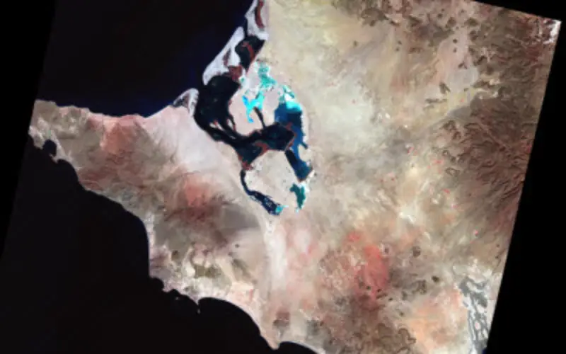
Landsat 8 Satellite Imagery: Landsat 8 data is available for anyone to use via Amazon Simple Storage Service (S3). All Landsat 8 scenes from 2015 are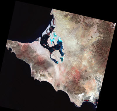 available along with a selection of cloud-free scenes from 2013 and 2014. All new Landsat 8 scenes are made available each day, often within hours of production. The satellite images the entire Earth every 16 days at a roughly 30 meter resolution. Learn more about Landsat on AWS.
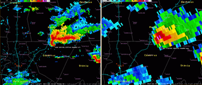
NEXRAD Weather Radar: The Next Generation Weather Radar (NEXRAD) is a network of 160 high-resolution Doppler radar sites that detects precipitation and atmospheric movement and disseminates data in approximately 5 minute intervals from each site. NEXRAD enables severe storm prediction and is used by researchers and commercial enterprises to study and address the impact of weather across multiple sectors. Learn more about NEXRAD on AWS.
SpaceNet Machine Learning Corpus: SpaceNet is a corpus of very high-resolution DigitalGlobe satellite imagery and labeled training data for researchers to utilize to develop and train machine learning algorithms. The dataset is made up of roughly 1,990 square kilometers of imagery at 50 cm resolution and 220,594 corresponding building footprints. Learn more about the SpaceNet corpus.
NASA Earth Exchange: The NASA Earth Exchange (NEX) makes it easier and more efficient for researchers to access and process earth science data. NEX datasets available on Amazon S3 include downscaled climate projections (including newly available Localized Constructed Analogs), global MODIS vegetation indices, and Landsat Global Land Survey data. Learn more about the NASA Earth Exchange.
Beyond Opening Data: Open data is only useful when you understand what it is and how to use it for your own purposes. To that end, Earth on AWS features videos and articles of customers talking about how they use geospatial data within their own workflows. From using Lambda to replace geospatial servers to studying migrating flocks of birds with radar data, there are a wealth of examples that you can learn from.