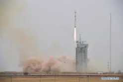
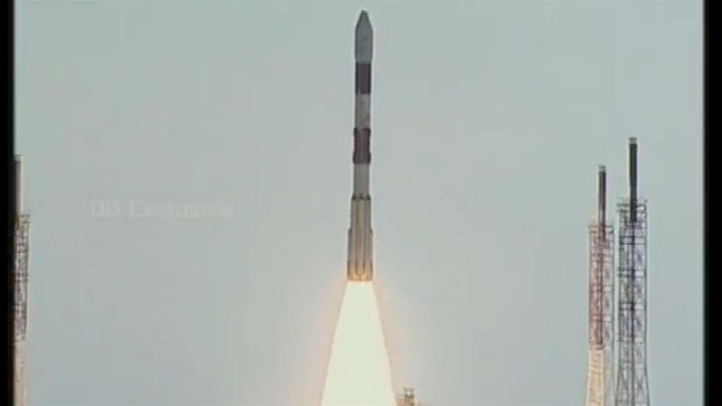
On 22 June 2016 at 05:55 CEST, the BIROS (Bi-Spectral Infrared Optical System) microsatellite was successfully launched into space from the Satish Dhawan Space Centre in India on board a Polar Satellite Launch Vehicle (PSLV). The German Aerospace Center (Deutsches Zentrum für Luft- und Raumfahrt; DLR) satellite will now search for high temperature events on Earth from an altitude of 515 kilometres.
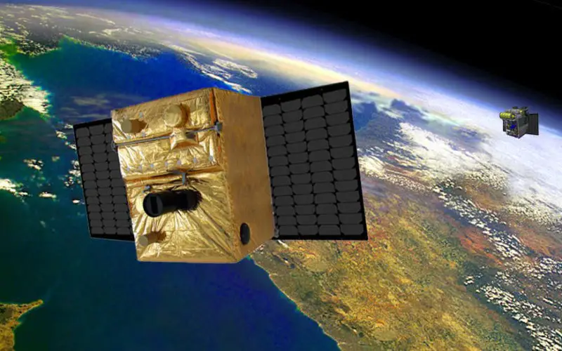
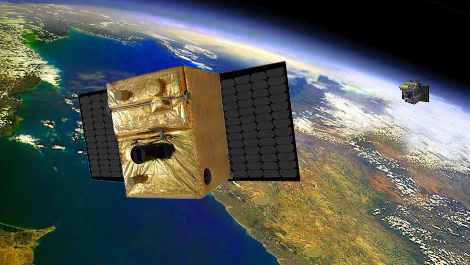
Microsatellites TET-1 and BIROS
Credit: DLR
But the refrigerator-sized satellite is not on its own. Its companion satellite, TET-1 (Technologie-Erprobungsträger; Technology Experiment Carrier), has been in orbit looking out for forest fires since July 2012. Together, the two satellites make up the FireBIRD (Fire Bispectral InfraRed Detector) remote fire detection mission. In addition to forest fires, volcanic activity, gas flares and industrial hotspots are expected to be observed and recorded.
Precise fire detection for climate protection
Fires are the cause of almost a third of all carbon dioxide emissions in the world and are largely anthropogenic in origin. Due to rising temperatures – attributable to climate change – the risk of forest fires will increase significantly in the future. “With its sensitive camera system, BIROS is capable of providing valuable data on changes in the surface temperature,” says Heinz-Wilhelm Hübers, director of the DLR Institute of Optical Sensor Systems. “At the same time, we hope to find out more about the effect of aerosols originating from combustion on the weather and climate, and thus be able to contribute to climate protection,” adds Hübers.
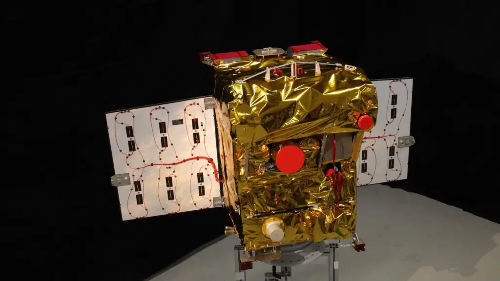
Mission to spot fires from afar
Credit: DLR
‘Magnifying glass’ in space
“With the high resolution infrared cameras on board the two FireBIRD satellites, it will be possible to reliably locate fires of even a limited intensity,” explains Winfried Halle, the project leader. The type of combustion can also now be identified from the exact determination of the intensity of the fire. “Furthermore, the satellites will allow us to accurately predict the dimensions of the area on fire for the first time,” says Halle.
Until now, it was only possible to approximately estimate the contribution of forest and savannah fires to the emission of climate-related gases, as people have had to rely on data from global Earth observation satellites that are only specialised in capturing normal temperatures. In doing so they have a relatively low level of accuracy outside of the optimal measurement range, which is between 25 and 35 degrees Celsius. Hence, the global Earth observation satellites can currently only record around 50 percent of all heat events.
Microsatellites TET-1 and BIROS
Credit: DLR
New technologies for remote fire detection
BIROS has a separate propulsion system. Specially developed dynamic reaction wheels give the micro-satellite a high level of agility and precision. Using laser communication, the position of high temperature events can be transmitted to ground stations on Earth, along with specific fire parameters such as temperature, energy or the area of fire sources that are already active or have just started. In addition, the 130-kilogram microsatellite can transmit information on high temperature events directly to mobile devices for the first time. The image data is pre-processed while still on board and sent via SMS using a special modem. This unique communication method between the satellite and the user is at the moment in the experimental phase. Furthermore, BIROS is hosting another satellite on board. During the mission, the BIROS pico-satellite from theTechnical University of Berlin will be released to carry out optical navigation experiments.
In addition, BIROS will act as a platform for technological experiments from the participating DLR institutes. The microsatellite has been developed by a total of nine DLR facilities and is funded by the German Federal Ministry of Education and Research (BMBF). The data is expected to be made available for global scientific use. FireBIRD has been designed for a lifetime of 10 years.
Mission control
Directly after the launch, the German Space Operation Center (GSOC) at the DLR site in Oberpfaffenhofenwill immediately take over communication with the satellite and bring it into its predetermined position. Following the initial testing of the instruments on board, BIROS and TET will operate together at an altitude of around 515 kilometres. In doing so, the flight operations, flight dynamics and mission planning teams will work closely with the participating scientists to precisely calculate the manoeuvring of the satellites and the resulting orbits, and then transmit them to the satellites. The available contact phases with the ground stations as well as the sunlit and shadowed phases of the orbits have to be taken into consideration when doing so.
To be able to guarantee regular contact times with the two FireBIRD satellites, DLR uses its global network of receiving stations. The S-band ground station network for routine operation consists of the two German ground stations at the DLR sites of Weilheim in Bavaria) and Neustrelitz in Mecklenburg-Vorpommern. In addition, the polar ground stations in Inuvik in Canada and O’Higgins in Antarctica will be used.