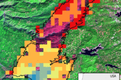
 ILOILO CITY, March 29 (PIA6) – The World Food Programme (WFP) will conduct a Geographic Information System (GIS) and Damage Assessment and Needs Analysis (DANA) training on March 31-April 4 here as part of the capability-building component of its ongoing Disaster Preparedness and Response Project.
WFP Country Director Aomo Asaka Nyangara said the training aims to develop a local GIS and capacity to conduct damage assessment and needs analysis which local government units can use for their disaster preparedness and response projects.
The training is also in preparation for the rollout of GIS projects in Iloilo.
The project is a collaborative undertaking with the Department of the Interior and Local Government (DILG), Department of Social Welfare and Development (DSWD), Office of Civil Defense (OCD), Provincial Government of Iloilo, City Government of Iloilo, municipal governments of San Joaquin and Tubungan, West Visayas State University, University of the Philippines in the Visayas, and NGO Iloilo Caucus Development (ICODE).
OCD headed by Regional Director Rosario T. Cabrera, who also chairs the Regional Disaster Risk Reduction and Management Council (RDRRMC) is coordinating the forthcoming activity at the local level. (JCM/JSC-PIA6)
Source: Philippine Information Agency, Jaime S. Cabag, Jr.


