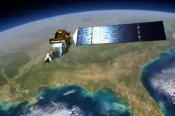
 The Ministry of Tribal Affairs (MoTA) is planning to use satellite mapping to identify potential water collection spots, which could be developed for fish culture and other purposes in order to employ people under the Mahatma Gandhi National Rural Employment Gurantee (MGNREGA) scheme.
The Ministry is also mulling over using space technology for creation of water bodies.
The MoTA Secretary had recently visited National Remote Sensing Centre (NRSC) under Department of Space, Hyderabad, where he studied the space applications and explained the needs from the perspective of tribal population.
The data on existing water bodies in districts having high tribal population will be sent by them in due course.
NRSC have been requested to use IR data of spectrum to identify places where there is water below the surface so that new water bodies can come up there, as the soil is impermeable there. This will require interpretation of the satellite imagery and NRSC is working on this,” said a senior Ministry official.
Schedules are being made for training of Integrated Tribal Development Agency (ITDA) staff, engineers from Irrigation and Soil Conservation Departments in the presence of officials of Department of Space and Remote Sensing Application Centres of states.
Prime Minister Narendra Modi had also stressed on working towards ‘technology penetration’ in tribal areas, including electricity and mobile phone reach.
“The aim is to bring a change in the quality of life. For the same, data relating to villages not having 2G mobile convergence have been processed and compiled district wise, and number of villages have been listed,” the official said.
– PTI


