
Tag "Washington"
Business
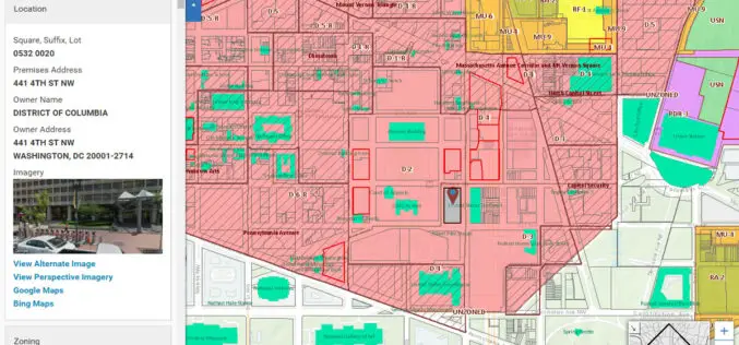
Blue Raster Incorporates Esri Technology into DC Office of Zoning Map
Constituents Can Leverage Open Data through Mobile Devices for Easy Access to Detailed Zoning and Planning Information Redlands, California—Esri has announced that the Washington, DC, Office of Zoning (DCOZ) has released

GIS
Washington State to Use LiDAR for Mapping of Geological Hazards
OLYMPIA, Washington – Gov. Jay Inslee has signed a bill that will allow Washington to have more information than ever about geologic hazards that threaten communities and citizens. Senate Bill
