
Tag "University of Maryland"
Remote Sensing
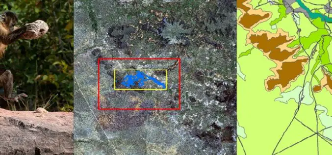
Remote Sensing Technology Is Used to Map Monkey with Hominid like Behavior
Biologists are fascinated by the applications of remote sensing and geographic information system (GIS) to the characterization of wildlife habitats as an area of growing significance for conservation. “Remote sensing
Remote Sensing
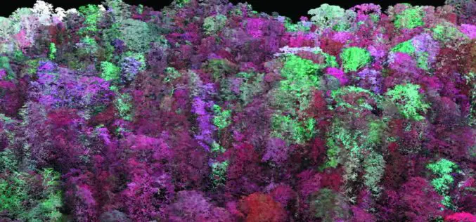
Laser Based Forest Mapping Instrument for Space Station
Laser-based technology will enable unprecedented measurements of 3-D forest structure A laser-based instrument for mapping the 3-D structure of Earth’s forests has passed a major milestone toward deployment on the
