
Tag "UAV"
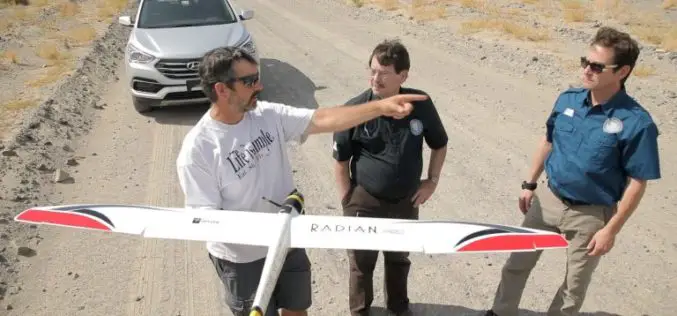
Advanced Artificially Intelligent Unmanned Aerial System (UAS) With Microsoft Researchers
Hawthorne, N.V. (August 10, 2017) – The Nevada Governor’s Office of Economic Development (GOED) and the Nevada Institute for Autonomous Systems (NIAS) has teamed up with Microsoft’s Unmanned Aerial System (UAS)

CompassDrone™ Announces CIRRUAS Drone Program for Public Safety Agencies
CENTENNIAL, Colorado, 10 August 2017 – CompassDrone, developers of unmanned aerial solutions for high-quality data collection, will unveil a comprehensive drone-based mapping program designed specifically for Public Safety applications. The
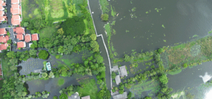
Tamil Nadu Government Started UAV Survey to Map Flood-Prone Areas
According to recent news by The Hindu, the Tamil Nadu Government in association with Anna University has launched an Unmanned Aerial Vehicle (UAV) for Photogrammetric mapping of water resources in Cuddalore
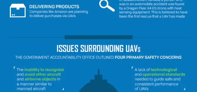
The Benefits and Challenges of UAVs
Ohio University Online The Federal Aviation Administration predicts that by 2017, the market for military UAVs will surpass $10 billion, while the Association for Unmanned Vehicle Systems International believes that
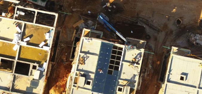
BZ Media and Skylogic Research Release “5 Valuable Business Lessons Learned About Drones in Asset and Infrastructure Inspection”
In-depth report dives into recent data points showing how drones are adding value to and creating innovations for inspection processes MELVILLE, N.Y., May 30, 2017 — BZ Media LLC announced
NASA Scientists Developed Technology to Help Drones Land Safely
PTI – WASHINGTON: NASA scientists have developed a new software that will help drones automatically spot the best places to crash-land in case of an emergency, without hurting anyone on
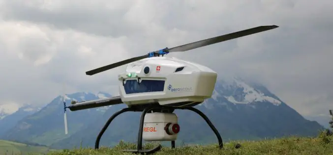
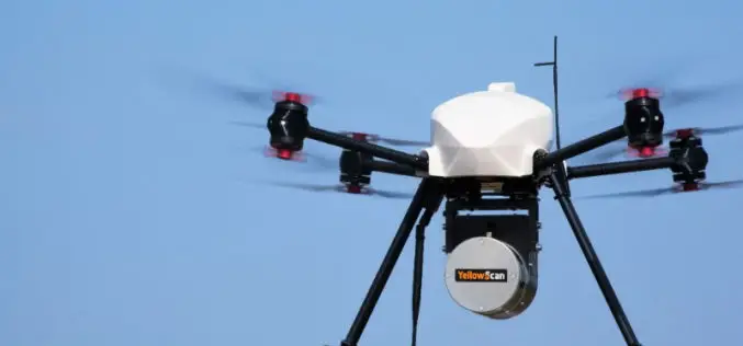
Swiss-based UAV Pioneer Aeroscout Introduced Their New Scout B-330 UAV Helicopter to the North American Market
Swiss-based UAV pioneer Aeroscout introduced their NEW Scout B-330 UAV Helicopter to the North American Market at this year’s AUVSI XPONENTIAL in Dallas, Texas! Aeroscout, a long-term partner of performance
Icaros Releases Version 5.0 of OneButton™ Drone Image Processing Software
Icaros Releases Version 5.0 of OneButton™ Drone Image Processing Software Free 30-Day Trial FAIRFAX, Virginia, USA, 15 May 2017 – Icaros Inc., a leading provider of aerial imaging software, is pleased

PrecisionHawk Launches Free PrecisionMapper Software for Drone Mapping
Now drone operators can stitch an unlimited number of photos, create maps without resolution limits and run algorithms to analyze their data for free PrecisionHawk, a leading commercial drone and
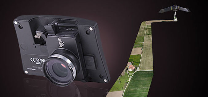
senseFly Corridor Solution Boosts Efficiency of Linear Mapping Projects
Today’s new combined hardware/software release makes assessing linear assets with UAS easier and less data-intensive than ever before senseFly, the world’s leading producer of mapping drones, today announces senseFly Corridor,
