
Tag "U.S. Geological Survey"

New National Geospatial Program Director Announced
The U.S. Geological Survey is pleased to announce the selection of Michael Tischler to the position of the Director, National Geospatial Program (NGP), starting Monday, April 6th. Mike brings a
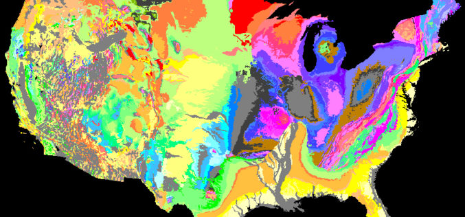
We Will Rock You – Geologic Map Day
The U.S. Geological Survey is partnering with the American Geosciences Institute, the Association of American State Geologists and others to promote the importance of geologic mapping to society. Celebrate the
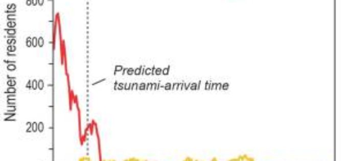
Pedestrian Evacuation Analyst Tool-Getting Out of Harm’s Way: Evacuation from Tsunamis
MENLO PARK, Calif. — Scientists at the U.S. Geological Survey have developed a new mapping tool, the Pedestrian Evacuation Analyst, for use by researchers and emergency managers to estimate how long
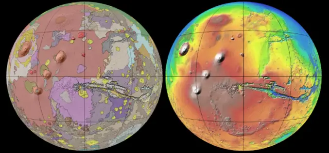
New Global Geologic Map of Mars
Understanding the Past to Enable Future Exploration A new global geologic map of Mars –the most thorough representation of the “Red Planet’s” surface – has been published by the U.S.
Digital Orthoimagery Base Specification V1.0
Abstract The resolution requirement for orthoimagery in support of the The National Map of the U.S. Geological Survey (USGS) is 1 meter. However, as the Office of Management and Budget
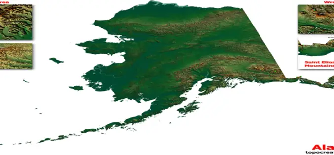
USGS Releases More Than 400 Updated US Topo Maps of Alaska
More than 400 new topographic maps are now available for the state of Alaska. The new maps are part of the U.S. Geological Survey Alaska Mapping Initiative, to update foundational data
