
Tag "Telangana"
Telangana Goes for Geo-tagging With the Help of NRSC and ICRISAT
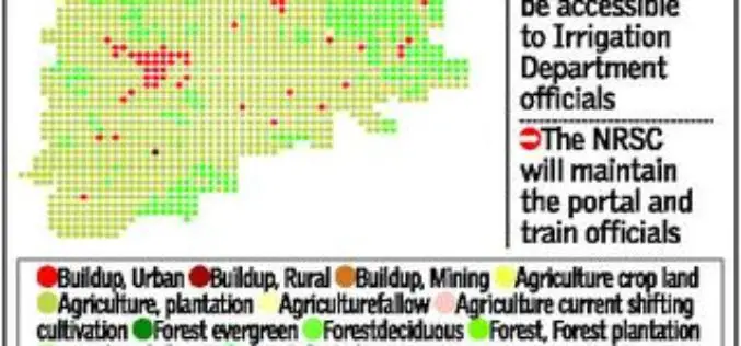
According to recent news by The Hindu, soon the citizens, farmers, administrators and policy makers can gain access to information about water availability and cropping pattern in all irrigation systems

Telangana State to go for Topographical Survey of Godavari River
According to recent news in Indian Express, the Telangana state government is determined to optimal utilization of allocated Godavari water falls. The state government has decided to go for topographical
Hyderabad – First City in India to Get Google Street View
The Telangana government has agreed to keep sensitive defence installations in Hyderabad out of Google Street View and the union home ministry is expected to soon give permission for the
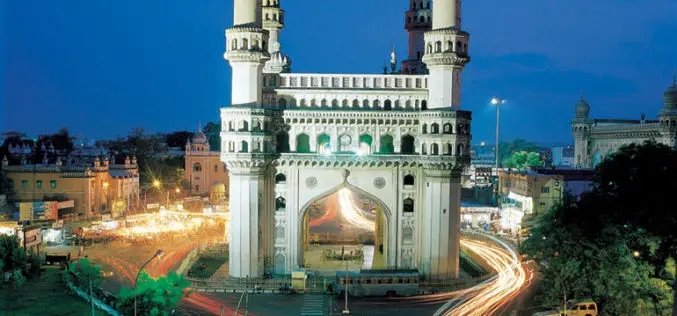
3D Mapping of Heritage Monuments for Tourism Promotion
According to recent news from ToI, the tourism department of Telangana state is going for 3D mapping of heritage monuments and buildings of city. Hyderabad city has many heritage monuments
Telangana Goes for Satellite Mapping
According to recent news, the Telangana state government has started project to map state-owned land through satellite imageries. Tamil Nadu based Info Maps as has already began work on some
Scientific Land survey for Telangana Districts
According to recent news, The Telangana government will soon start a scientific integrated land information survey in nine districts of the state. The estimated time period to complete the task
