
Tag "Taiwan"
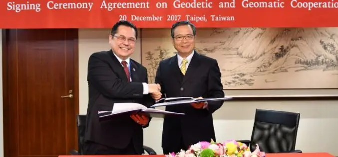
Taiwan and Indonesia Signed Pact on Cooperation in Geodesy and Geomatics
According to recent news reported by the Taiwan News, Taiwan and Indonesia have signed a pact on Dec. 20 to foster cooperation in geodesy and geomatics, the scientific fields concerned with
Taiwan to Use Japan’s Satellite Services Until FORMOSAT-5 is Launched
According to recent news by the Taipai Times, Taiwan would seek to use Japan’s satellite services until its newest satellite, the FORMOSAT-5, can be launched later this year. Minister of
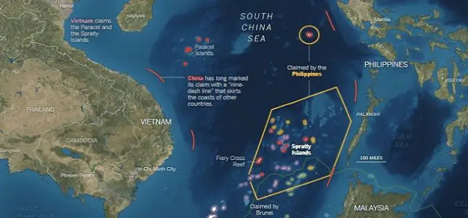
What’s Drives China in the South China Sea? A GEOINT View
Contributed By: The Spratly Islands are a group of more than 750 reefs, islets, atolls, cays and islands in the South China Sea. The history of territorial claim on these

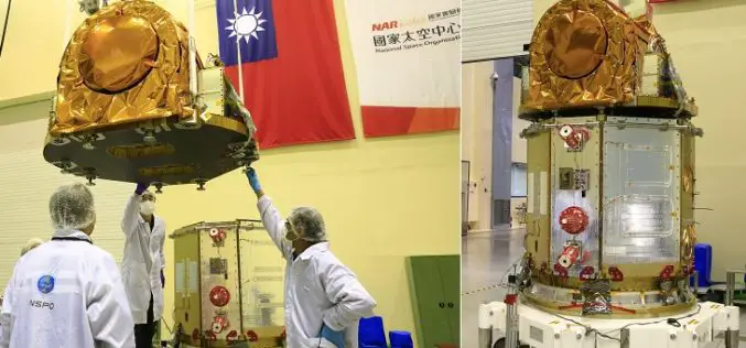
Taiwan to Launch FORMOSAT-5 Satellite in February 2016
The FORMOSAT-5 satellite has passed space environment and function tests and is expected to be launched at the end of February 2016. The FORMOSAT-5 will replace FORMOSAT-2. The biggest difference
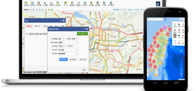
Geospatial Data in Taiwan – Focus on Integration
Supergeo’s biggest application customer in Taiwan, Ministry of the Interior and the TGOS platform, has just announced one of the biggest projects in the GIS field from ide@ Taiwan 2020
