
Tag "Social Media"
GIS
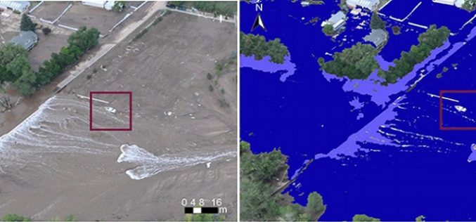
Mining Social Media to Task Satellite Data Collection During Emergencies
Combining satellite imagery with social media data enables a good match between predictions and observations in emergency situations. The era of Internet and social media has drastically changed the way
