
Tag "satellite mapping"

Satellite Mapping of Kedarnath to Boost Tourism
According to recent news by the Hindustan Times, the state government of Uttrakhand is set to conduct mapping of Kedarnath area, including the famed shrine town, using high-resolution satellite images
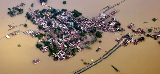
Bihar the Most Flood-prone State of India Aided by New Satellite Mapping
BHUBANESWAR, India (Thomson Reuters Foundation) – Every year Bihar is deluged by floods that submerge roads, destroy homes and wash away crops, leaving the disaster management authority struggling to monitor

PCI Geomatics Webinar: Digital Elevation Models and Operational Mining Applications
Digital Elevation Models and Operational Mining Applications Case Study with NPA Satellite Mapping JUNE 29, 2016 | 10AM ET / 2PM GMT PCI Geomatics and CGG’s NPA Satellite Mapping team will
Satellite Mapping for Property Tax Recovery
According to recent news by ToI, Navi Mumbai Municipal Corporation (NMMC) property department may levy property taxes which will also account for the alterations done from this year. The department

CIDCO to Fight Encroachments Using Satellite Mapping
Navi Mumbai: The City and Industrial Development Corporation of Maharashtra (CIDCO) has tied up with a Central government agency, which will provide satellite mapping every fortnight keeping an eye on
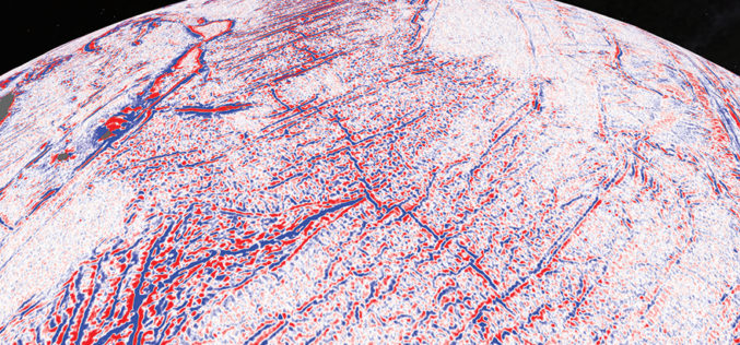
Satellite Maps Reveal Small Tectonic Plate in the Indian Ocean
A team of Australian and U.S. researchers has found a small tectonic plate or microplate in the Indian Ocean. Using Satellite maps, researchers discovered the Indian Ocean microplate, called Mammerickx Microplate and measuring

Geospatial Technology Helps Indian Air Force to Rediscover Lost Land
After a year of search with the help of satellite mapping and pain staking ground survey, a team of UP Board of Revenue and Indian Air Force (IAF) has been
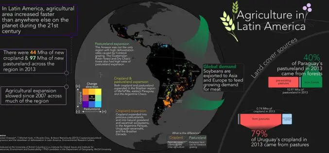
Remote Sensing to Study Dynamics of Cropland in Latin America
In a study, “Cropland/pastureland dynamics and the slowdown of deforestation in Latin America,” published in Environmental Research Letters by Jordan Graesser and et. al., brings out some interesting facts about

Tribal Ministry to Use Satellite Mapping to Develop Water Bodies
The Ministry of Tribal Affairs (MoTA) is planning to use satellite mapping to identify potential water collection spots, which could be developed for fish culture and other purposes in order

Maharashtra to Launch Rs. 4,000-Cr Satellite Mapping Project
India, the Maharashtra Government will soon launch a Rs. 4,000-crore satellite imaging project to map all land in the State and prepare digital records of land holdings. “We have decided to undertake
