
Tag "remote sensing"
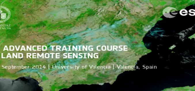
5th ESA Advanced Training Course on Land Remote Sensing
5th ESA Advanced Training Course on Land Remote Sensing : 8-12 September 2014, University of Valencia, Valencia, Spain As part of the Scientific Exploitation of Operational Missions (SEOM) programme element, the

UD Partners with Research Group for Sensors Curriculum
The University of Dayton is adding new curriculum for sensors and intelligence by partnering with a local research group. UD and Riverside Research will offer a new course, Fundamentals of Remote Sensing & Technical

Write a Remote Sensing Lesson and Win €5,000
European Space Agency is funding a competition with €5,000 as first prize for writing a remote sensing lesson Do you use Earth Observation data for teaching? Or do you
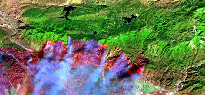
It’s Time to Give Firefighters a 21st century Tool: A Fire-Spotting Satellite
Scientists from UC Berkeley Develop Framework For Fire-Spotting Satellite UC Berkeley researchers have developed an initial framework for a satellite that could one day help locate emerging fires and
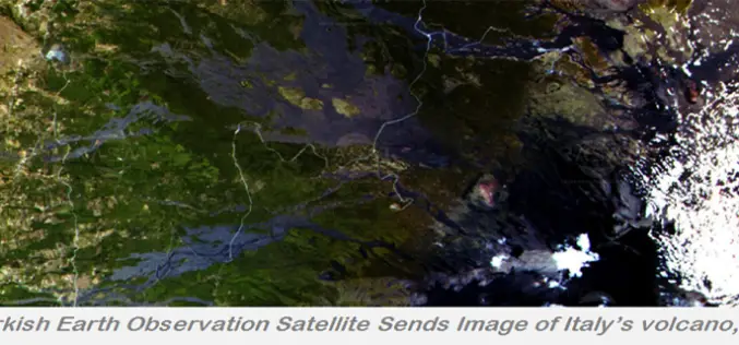
Turkey’s First EO Satellite RASAT Starded Transmitting Images From Space
Images from different parts of the world recorded by the first Turkish made remote sensing satellite RASAT, designed, developed, tested and operated by TÜBİTAK UZAY, the space technologies research institute
Remote Sensing and Geographical Information Systems – M. Anji Reddy
Remote Sensing and Geographical Information Systems by M. Anji Reddy Download Remote Sensing and Geographical Information Systems by M. Anji Reddy “This blog does not host any contents or data. All
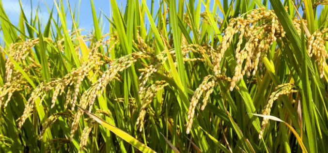
Hyperspectral Remote Sensing Imaging of Rice to Detect Arsenic Contamination
Arsenic toxicity of humans due to consumption of arsenic-contaminated rice is an international health crisis. Arsenic is often supplied through water from shallow wells used for irrigation of rice. Reduced
Remote Sensing of Agriculture (NASS’ Cropland Data Layer Program)
Remote Sensing of Agriculture (NASS’ Cropland Data Layer Program) Download Remote Sensing of Agriculture (NASS’ Cropland Data Layer Program “This blog does not host any contents or data. All the files linked
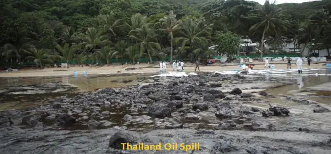
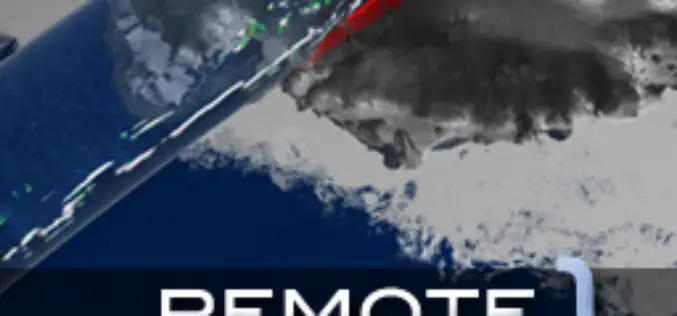
Satellite image shows Thailand’s oil spill
BANGKOK – The oil spill that hit Thailand’s popular Koh Samet island appears to be moving to coastal areas of the eastern province of Rayong, threatening to worsen the impact
Fundamemtals of Hyperspectral Remote Sensing
Introduction Hyperspectral remote sensing is the science of acquiring digital imagery of earth materials in many narrow contiguous spectral bands. Hyperspectral sensors or imaging spectrometers measure earth materials and produce
