
Tag "remote sensing"

ISRO Launches EOS-01 and Nine Other Satellites
EOS-01 is an earth observation satellite intended for applications in agriculture, forestry and disaster management support.
Aspectum and Planet Enter into a Partnership to Offer Powerful Analytics Paired With Robust Satellite Imagery
New partnership that allows Aspectum users to access Planets high-resolution satellite imagery and rich geospatial data Aspectum and Planet have announced the formation of a strategic partnership to offer businesses
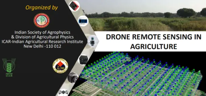
Full-Day Webinar on Drone Remote Sensing in Agriculture
Indian Society of Agro-Physics in association with ICAR- IARI is organizing one day webinar on Drone Remote Sensing in Agriculture. Hurry last date to apply is August 31, 2020.
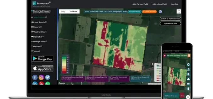
Satellite-Based Crop Health Monitoring System to Help Farmers
Farmonaut started in 2018 with a vision to bridge the technological gap between farmers and strives to bring state-of-the-art technologies in the hands of every farmer.
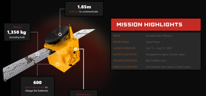
UAE Launches Mission to Mars – Emirates Mars Mission “Hope Probe”
The United Arab Emirates (UAE) Mars Mission “Hope Probe” to Mars is the first Arab Interplanetary Mission to provide a complete picture of the Martian atmosphere and its layers when it reaches the red planet’s orbit in 2021.
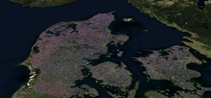
Machine Learning Helps SEGES to Detect 26K Slurry Tanks over Denmark to Assess Ammonia Emission
The article talks about How SEGES detected 26000 slurry tanks over Denmark in a few hours using Picterra to assess ammonia emission.

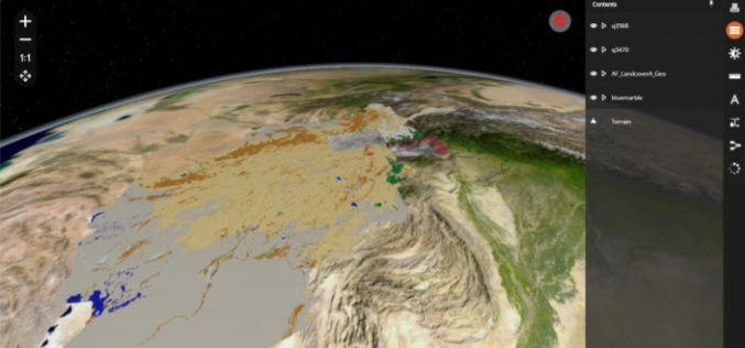
Get More from Imagery Using 30 New Features Released to Geomatica Banff
PCI Geomatics has announced the release of over 30 new features and enhancements to photogrammetry and remote sensing solution, Geomatica Banff.
Join MAXAR to Learn How Satellite Data is used by Organizations in Responding to Business Disruption and Emerging from Lockdown
Join MAXAR to Learn How Satellite Data is used by Organizations in Responding to Business Disruption and Emerging from Lockdown
Hexagon Geospatial Releases M.App X 2020 Update 1 – Cloud-based Enterprise Solution for Imagery Intelligence
Hexagon Geospatial has recently released M.App X 2020 Update 1 with great new features. The major version of M.App X 2020 was released late in January 2020. M.App X is a
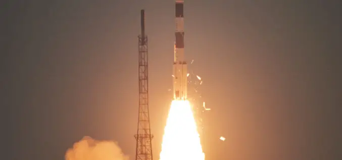
ISRO Successfully Launches Cartosat-3 and 13 Commercial Nanosatellites
November 27, 2019 – ISRO – India’s Polar Satellite Launch Vehicle, in its forty-ninth flight (PSLV-C47), successfully launched Cartosat-3 along with 13 Nanosatellites of USA from Satish Dhawan Space Centre
