
Tag "Radar imaging"
GIS
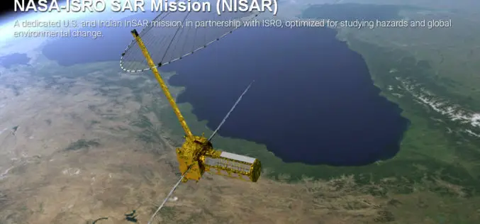
Opportunity for Young Scientist to be a Part of NASA-ISRO Synthetic Aperture Radar (NISAR) Data Program
AHMEDABAD: Here is a chance for young scientific researchers and data crunchers to be part of Isro’s ambitious NASA-ISRO Synthetic Aperture Radar (NISAR) satellite data analysis program. This will be

GIS
ISRO Has Launched Remote Sensing Satellites in Thematic Series, Says Jitendra Singh
New Delhi, India Dec. 9: Union Minister of State for Space Jitendra Singh on Wednesday informed the Lok Sabha that Indian Space Research Organisation (ISRO) has launched Remote Sensing Satellites
Remote Sensing
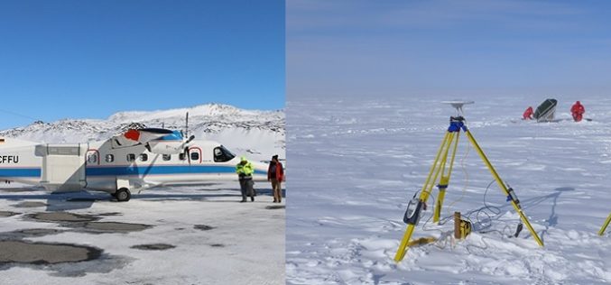
Airborne Radar Scanning of Glaciers for Climate Change Modeling
Greenland’s ice sheet is the second largest mass of ice on Earth, containing enough water to raise ocean levels by about 20 feet. The ice sheet has been losing mass
