
Tag "Precision Agriculture"

Farmonaut Partners With GarudaUAV to Provide Drone-Based Remote Sensing Technologies for Farming in India
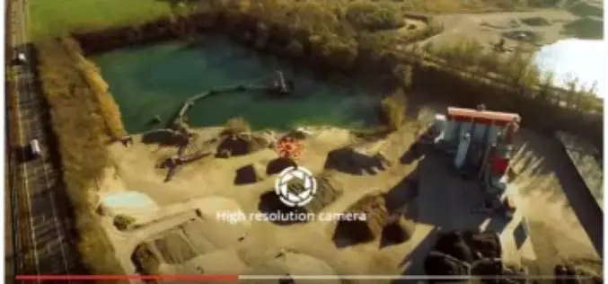
Farmonaut has come together with a leading Indian drone services company, GarudaUAV, engaged in aerial data acquisition, analysis, and reporting for the promotion of drone-based remote sensing technologies for farming

SimActive Software for Precision Agriculture in Brazil
June 12, 2018 – SimActive Inc. is proud to announce use of its software for precision agriculture in Brazil by Portal Produtos Agropecuários Ltda (Portal). Drone data is transformed into
5 Drones for Precision Agriculture on Geo-matching.com
Drones (also known as Unmanned Aerial Vehicles) are used for various applications such as surveying, surveillance and habitat mapping. An interesting new application is precision agriculture. Drones can be used
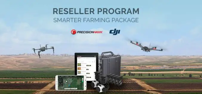
PrecisionHawk Launches Reseller Program for Smarter Farming Package
PrecisionHawk, a leading drone and aerial data analytics provider, has formally launched a reseller program for itsSmarter Farming package that rolled out in partnership with drone manufacturer DJI in May.
Unleash Agri-Production With Geospatial Technology
Contributed By:- “Food security exists when all people, at all times, have physical, social and economic access to sufficient, safe and nutritious food that meets their dietary needs and food
Drones to Access Crop Condition and Farming Possibilities
Drones in agriculture have transformed the way of capturing remotely sensed data and have proven their capability in many other domains. With the capability of acquiring high resolution data (spatial, spectral,

Strong Increase Enquiries on UAVs for Mapping and 3D Modelling in 2015
Geo-matching.com is the first independent product comparison website for geomatic, hydrographic and related industries field. Especially the enquiries and traffic on UAS for Mapping and 3D Modelling products have shown
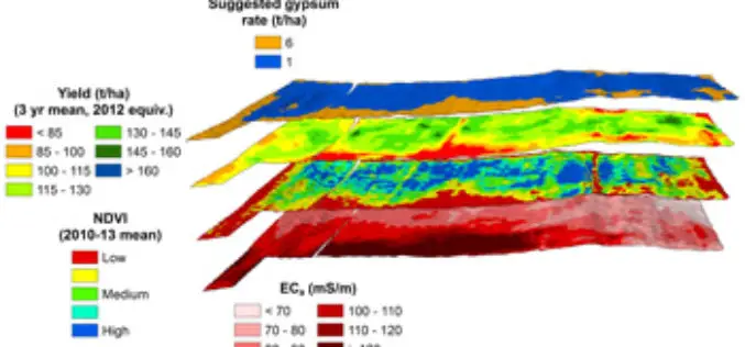
Crop and Soil Mapping Boosts Potential for Increased Yields
A research project started at 2008 by Sugar Research Australia (SRA) with additional support from QDAFF, the collaborative project brings together research expertise from CSIRO, the University of Southern Queensland’s
Drone to Spread Beneficial Bugs on Crop
University of Queensland agricultural science student Michael Godfrey has developed a drone that spreads beneficial insects onto crops, potentially saving farmers time and money. During his Summer Science Scholarship, Mr
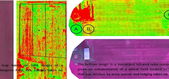
Applications of Low Altitude Remote Sensing in Agriculture
In a study by Chunhua Zhang et. al., on “Applications of Low Altitude Remote Sensing in Agriculture upon Farmers’ Requests– A Case Study in Northeastern Ontario, Canada” reveals the importance
