
Tag "point cloud"
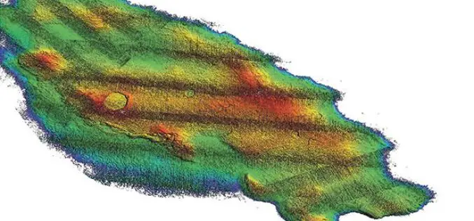
3D Map Tools Launched for Maltese Islands
According to recent news by the Times of Malta, Cloudisle – a series of baseline 3D maps of Malta that will serve as the base for research in cross-thematic fields –

Sanborn Announces Launch of GeoServe LiDAR Viewer and QC Interface
Online LiDAR Viewer Will Streamline Client QC Processes, Ensure Quality Results, and Expedite Project Delivery COLORADO SPRINGS, Colo., Feb. 14, 2017 /PRNewswire/ — The Sanborn Map Company, Inc. (Sanborn) announces
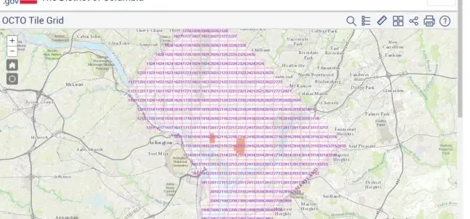
Classified LiDAR Point Cloud of Columbia Available on Amazon S3
According to recent updates on Amazon AWS, LiDAR point cloud data for Washington, DC is available for anyone to use on Amazon S3. The dataset, managed by the Office of the Chief
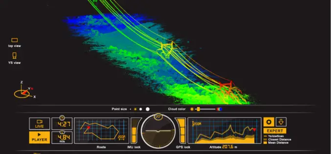
ILMF 2017: YellowScan Launches YellowScan LiveStation
ILMF 2017: YellowScan launches YellowScan LiveStation, Real-time in-flight LiDAR Station, a must for long endurance and critical LiDAR flights Yellowscan is very pleased to announce the launch of the YellowScan

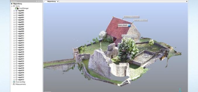
GeoSLAM Launches Desktop V3
GeoSLAM is delighted to announce the launch of Desktop V3, the latest release of their industry leading SLAM registration software. January 31, 2017 – GeoSLAM Desktop V3 builds on the success
DAT/EM Systems International Releases Software Version 7.3
Anchorage, Alaska, USA. September 27, 2016 – DAT/EM Systems International® announces the release of the 7.3 edition of DAT/EM software products. Updated products include Summit Evolution™ 3D photogrammetric workstation, LandScape™ 3D point

LiDAR Technology for Monitoring Bridge Structure Defect and Health
Road infrastructure of a country plays a crucial role in the national economy. Among all road infrastructure, Bridges are one of the vital assets and histories has given us various evidence
FARO Releases SCENE Version 6.1, Introducing a Fully Integrated Point Cloud to 3D Mesh Engine for Product Design and Construction BIM-CIM Professionals
Lake Mary, FL, September 6, 2016, 2016 – FARO (NASDAQ:FARO), the world’s most trusted source for 3D measurement and imaging solutions for factory metrology, product design, construction BIM/CIM, public safety
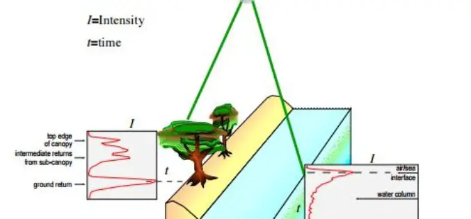
Algorithms used in the Airborne Lidar Processing System (ALPS)
The Airborne Lidar Processing System (ALPS) analyzes Experimental Advanced Airborne Research Lidar (EAARL) data—digitized laser-return waveforms, position, and attitude data—to drive point clouds of target surfaces. A full-waveform airborne lidar
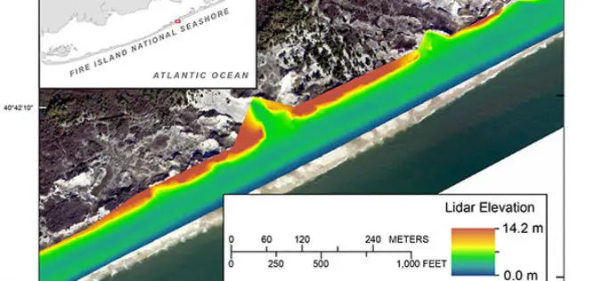
Terrestrial-based Lidar Beach Topography of Fire Island, New York
Abstract: The U.S. Geological Survey (USGS) St. Petersburg Coastal and Marine Science Center (SPCMSC) in Florida and the USGS Lower Mississippi-Gulf Water Science Center (LMG WSC) in Montgomery, Alabama, collaborated to
