
Tag "Photogrammetry"
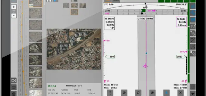
Phase One iX Suite for Aerial Mapping Planning to Delivering the Final Images
Phase One has released the iX Suite, a photogrammetry workflow software. The iX Suite is a comprehensive software suite for managing aerial mapping projects. iX Suite manages mission planning, flight
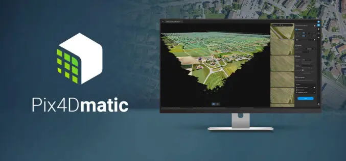
Pix4Dmatic Latest Digital Photogrammetry Software
Pix4D a leader in digital photogrammetry software provider has launched Pix4Dmatic. Pix4Dmatric software is more accurate and apt for fast corridor and large scale mapping. Pix4Dmatic is designed to work
Let’s Talk About: Educational Resources on Photogrammetry
Photogrammetry enables you to capture three-dimensional models from images taken using digital cameras. The process is carried out using affordable software and gets accomplished in a very automatic manner. That
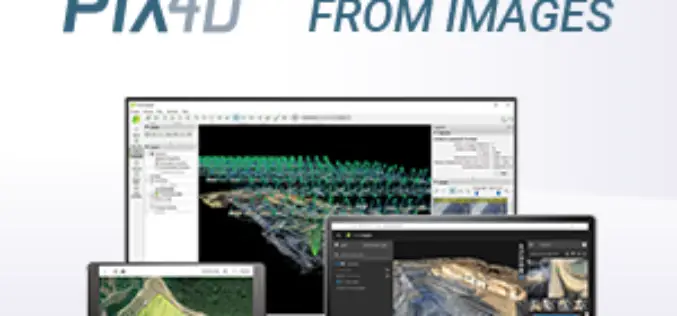
Pix4D Announces A New Generation of Tools for Photogrammetry, Drone Mapping and Analytics
Lausanne, Switzerland, March 31st, 2020 – Photogrammetry leader Pix4D is announcing today the commercial release of next-generation software addressing the modern-day professional challenges. Developed in close collaboration with customers and
Most Common Business Uses of Photogrammetry
Contributed by – Photogrammetry is the use of photography in surveying and mapping. It’s used to measure distances between objects, and photogrammetry software can utilize images to create 3D renderings.

Skyline Software Systems Releases Photomesh™ 7.4 With LiDAR Integration and Improved Aerial Triangulation Capability
Herndon, VA – May 21, 2018 – Skyline Software Systems Inc. announced today that it has released PhotoMesh™ v7.4 software suite as part of its SkylineGlobe products. This update integrates
ICAROS Uses TatukGIS SDK to Develop Integrated Aerial Geospatial Data Viewer
Aerial geospatial solutions provider, Icaros, Inc., selected the TatukGIS Developer Kernel (DK) to develop the next generation geospatial data viewer component of its OneButton™ software product, which is used to

Pix4D is Expanding Globally
Capturing a billion dollar market with advanced computer vision, machine learning, and photogrammetry December 07, 2017 – Pix4D is adding two senior executives to our leadership team to strengthen our global

SimActive Introduces New Technology for True Orthos
November 28, 2017 – SimActive Inc., a world-leading developer of photogrammetry software, is pleased to announce Correlator3D™ version 7.1 with revolutionary technology for true orthos. Users can now automatically generate enhanced

Pix4D Announces a New User Certification Program
Drone technology is rapidly evolving and our technology is changing daily. Being a Pix4D certified user will allow users to benchmark their skills and technical knowledge of drone mapping photogrammetry.
