
Tag "Photogrammetric Software"
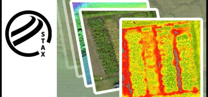
PCI Geomatics Releases STAX for UAV
MARKHAM, Ontario, Canada — March 07, 2017: PCI Geomatics, a world-leading developer of remote sensing and photogrammetric software and systems, announced today that it has released a new UAV image

PCI Geomatics Marks Milestone in Cloud-Based Image Processing
MARKHAM, Ontario, Canada, January 17, 2017 — PCI Geomatics, a world-leading developer of remote sensing and photogrammetric software and systems, announced today that it is six years since it began

PCI Geomatics Announces Collaboration with Deimos Imaging to Support the PanGeo Alliance
MARKHAM, Ontario, Canada—January 10, 2017: PCI Geomatics, a world-leading developer of remote sensing and photogrammetric software and systems, announced today it will be collaborating closely with Deimos Imaging to support
PCI Geomatics and PrecisionHawk Enter into Long Term Partnership
MARKHAM, Ontario, Canada—September 20, 2016: PCI Geomatics, a world-leading developer of remote sensing and photogrammetric software and systems, announced today it has entered into a long-term partnership with PrecisionHawk, a
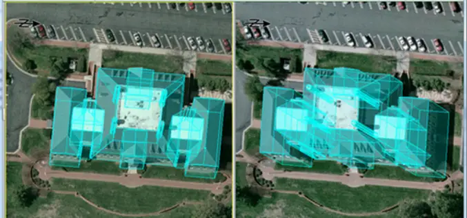
PCI Geomatics and IAVO-RS Announce Update to 3D FeatureXtract Software
PCI Geomatics, a world-leading developer of remote sensing and photogrammetric software and systems, announces with its partner IAVO, the release of 3D FeatureXtract (3DFE). By calculating feature heights and outlines
