
Tag "Open Data"
EuroGeographics Announces New Additions to Open Data for 2018
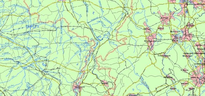
February 20, 2018 – EuroGeographics has released a new version of EuroGlobalMap, its open data created from official national sources. Forty-five members of the Association for the European National Mapping, Cadastral
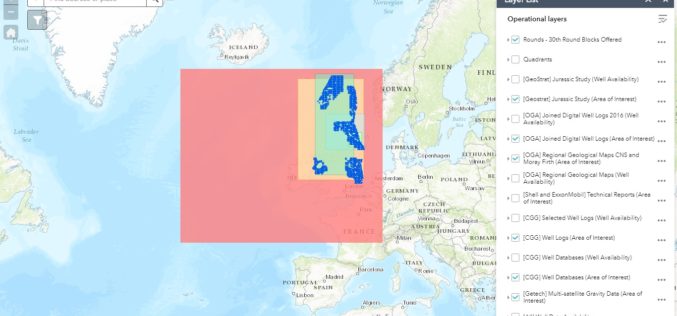
OGA Makes Another Set of Data Packages Openly Available for Oil and Gas Explorers
The Oil and Gas Authority (OGA) is continuing to make more and more data openly available in an effort to help revitalise exploration of oil and gas in the UK
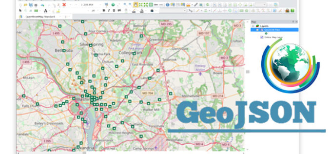
Embrace GeoJSON Format Together with SuperGIS Desktop
In recent years, as value-added services get increasingly popular in IT industry and civic engagement becomes a new trend in governance, the idea of Open Data turns out to be

Open Data: Engine for Innovation or Simply Hot Air?
Open Data: Engine for Innovation or Simply Hot Air? Karlsruhe/Berlin, 25 May 2017 | The INTERGEO conference will be hosting what promises to be an exceptionally transparent panel discussion between
Swiss Geospatial Data Now Available as Linked Data
The Swiss geoportal has started to publish geospatial data as linked data. This geoportal is harvested by the national Swiss Open Data portal, which is in turn harvested by the
EuroGeographics Enhances Open Data for 2017
February 22, 2017 – Users of EuroGeographics pan-European open data will benefit from a series of enhancements to the latest release of EuroGlobalMap. Forty-five members of the Association for the
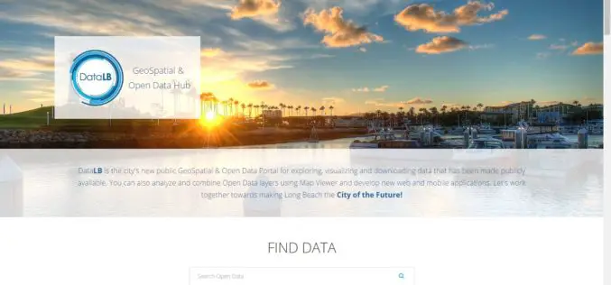
City of Long Beach Launched GeoSpatial & Open Data Portal
Long Beach One of First Cities in U.S. to Display Open Data in Geospatial Data Format The City of Long Beach launched DataLB, the City’s new Open Data Portal on
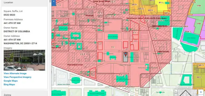
Blue Raster Incorporates Esri Technology into DC Office of Zoning Map
Constituents Can Leverage Open Data through Mobile Devices for Easy Access to Detailed Zoning and Planning Information Redlands, California—Esri has announced that the Washington, DC, Office of Zoning (DCOZ) has released
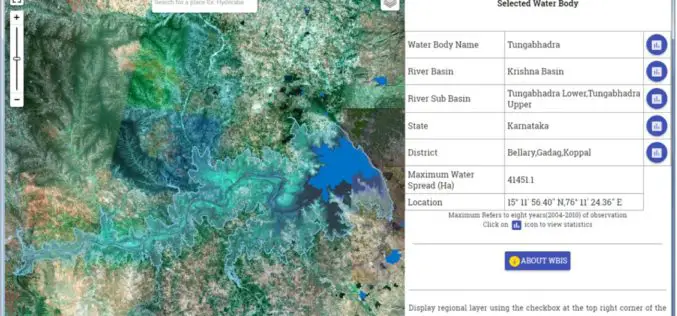
Temporal Repetitive Mapping of Water Bodies Across India
National Remote Sensing Centre (NRSC), ISRO at Hyderabad monitors the status of all the water bodies in the country using satellite images and provides water spread area information on a

Assessing the Socioeconomic Impact and Value of Open Geospatial Information
Assessing the Socioeconomic Impact and Value of Open Geospatial Information By: Francoise Pearlman, Jay Pearlman, Richard Bernknopf, Andrew Coote, Massimo Craglia, Lawrence Friedl, Jason Gallo,Henry Hertzfeld, Claire Jolly, Molly Macauley, Carl
