
Tag "OGC"
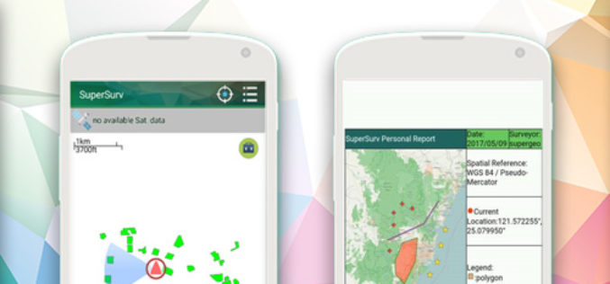
New Features of SuperSurv 10 that You Cannot Ignore
The global IT industry is skyrocketing today, and so does the development of geospatial industry, especially the progress of integrating GIS and GNSS technologies into mobile devices. Base on such
Esri ArcGIS 10.5 Leading Platform in OGC Compliance
The Transformative Software Receives over 30 OGC Compliance Certificates June 7, 2017 – Redlands, California—Esri, the global leader in spatial analytics, today announced that it has received over 30 compliance
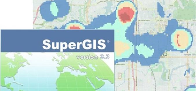
Supergeo Releases the Latest Update of SuperGIS Desktop 3.3
Developed by one of worldwide leading providers in GIS software- Supergeo, SuperGIS Desktop is a practical, multifunctional, and affordable GIS solution designed for professionals in various industries such as urban

OGC invites you to its Environmental Linked Feature Interoperability Experiment: ELFIE
Monday, 8 May 2017 UTC – The Open Geospatial Consortium (OGC®) invites interested members & non-members alike to participate in the OGC Environmental Linked Feature Interoperability Experiment (ELFIE). In recent years,

Europa Technologies Celebrates Earth Day with New Release of Global Data Suite
In tribute to Earth Day 2017, Europa Technologies has announced the latest major version (v2017.1) of its market-leading suite of global map data products. As a publisher of rich data
OGC seeks public comment on candidate OGC Web Coverage Service 2.0 Interface Standard – Earth Observation Application Profile 1.1
The Open Geospatial Consortium (OGC®) is seeking public comment on its Web Coverage Service 2.0 Interface Standard – Earth Observation Application Profile 1.1. This OGC WCS Application Profile – Earth
OGC Seeks Public Comment on ‘GML Application Schema – Coverages, GRIB2 Coverage Encoding Profile’ Candidate Standard
The Open Geospatial Consortium (OGC®) is seeking public comment on the candidate standard GRIB2 Coverage, an Encoding Profile of the OGC Coverage Implementation Schema. The candidate standard specifies the usage
OGC Requests Public Comment on Proposed Indexed 3D Scene Layers (I3S) Community Standard
The Open Geospatial Consortium (OGC®) is requesting public comment on the proposed Indexed 3D Scene Layers Community Standard. Indexed 3D Scene Layers (I3S) was submitted by Esri for consideration as
OGC Seeks Public Comment on proposed Unmanned Systems Domain Working Group
The Open Geospatial Consortium (OGC®) seeks comments on the draft charter of a proposed Unmanned Systems Domin Working Group (UXS DWG). The proposed DWG will provide an open forum for
OGC Calls for Public Review of Proposed Common Object Model Container Standards Working Group
March 09, 2017 – The Open Geospatial Consortium (OGC®) request comments on the draft charter for an OGC Common Object Model Container (COMC) Standards Working Group (SWG). The core philosophy behind the
