
Tag "NOAA"
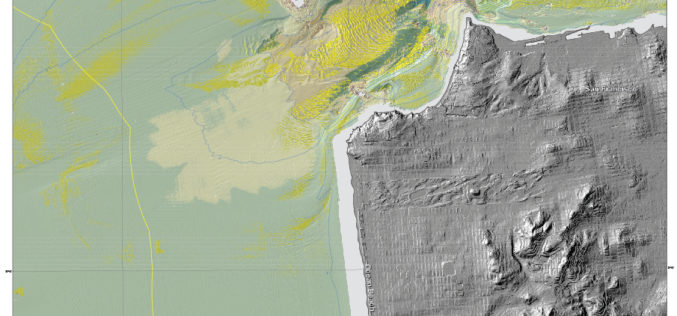
New Maps Reveal Seafloor off San Francisco Area
SANTA CRUZ, Calif. — Three new sets of maps detail the offshore bathymetry, habitats, geology and submarine environment of the seafloor off the coast of San Francisco, Drakes Bay, and

ESA and Airbus Defence and Space sign Contract for New Copernicus Earth Observation Mission
Jason-CS/Sentinel-6 keeps its eye on the oceans’ surface topography New Copernicus satellite scheduled for launch in 2020 At the 36th International Symposium on Remote Sensing of Environment in Berlin, the European
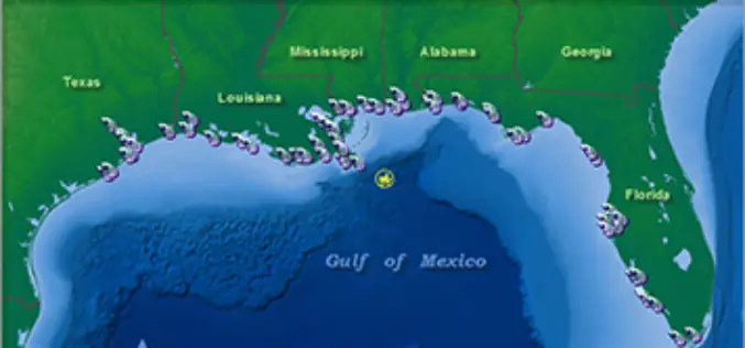
NOAA’s Online Mapping Tool ERMA Opens up Data to the Public
NOAA’s Environmental Response Management Application (ERMA) is a web-based mapping application that pulls in and displays both static and real-time data, such as ship locations, weather, and ocean currents. ERMA enables

NOAA and NASA Launch Coastal Vulnerability Innovation Challenge
Coastal communities are becoming increasingly vulnerable to the risk of damage from coastal inundation. We only have to remember the recent impact of Hurricane Sandy on communities in the northeast

NOAA’s National Geodetic Survey : 2014 GPS on Bench Marks Campaign
NGS encourages anyone with survey-grade Global Positioning System (GPS) receivers to join the 2014 GPS on Bench Marks Campaign, a National Surveyors Week (March 16-22) event to raise awareness about professional surveying
