
Tag "NASA"
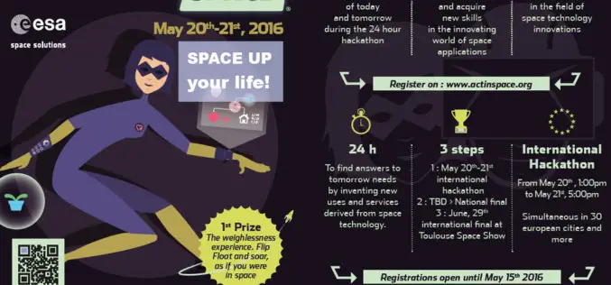
ActInSpace: The Space Technology Challenge
Airbus Defence and Space is partnering with the French and European space agencies (CNES and ESA*) to organise ActInSpace. ActInSpace is a 24-hour contest where anyone can join a team
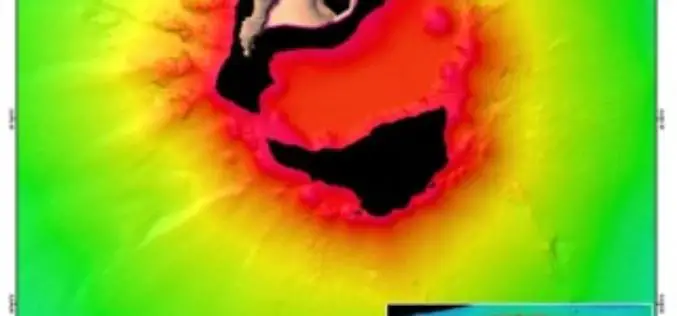
Scientists Explore Earth’s Newest Land Using Advanced, High-Resolution 3D Mapping
SUVA, FIJI – Research vessel (R/V) Falkor will return to port today after 28 days at sea conducting pioneering studies including mapping the Earth’s newest island landscape in the Kingdom

NASA ARSET Training: Using NASA Remote Sensing for Disaster Management
NASA ARSET Training: Using NASA Remote Sensing for Disaster Management 06/09/2016 to 06/30/2016 Times: 11:00 a.m.-12:00 p.m. and 6:00-7:00 p.m. EDT (UTC-4) NASA remote sensing and modeling resources are useful for
Fundamentals of Satellite Remote Sensing for Health Monitoring
NASA ARSET Training: Fundamentals of Satellite Remote Sensing for Health Monitoring 02 Jun. 2016 to 30 Jun. Times: 10:00-11:30 a.m. and 3:00-4:30 p.m. EDT (UTC-4) Predicting and monitoring disease outbreaks and environmental
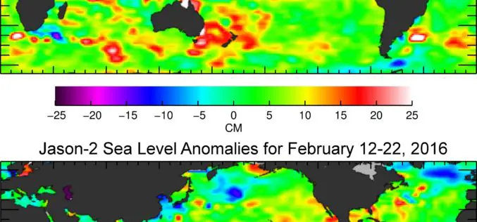
Jason-3 Begins Mapping Oceans
Just over a month after launch, Jason-3, a U.S.-European oceanography satellite mission with NASA participation, has produced its first complete science map of global sea surface height, capturing the current
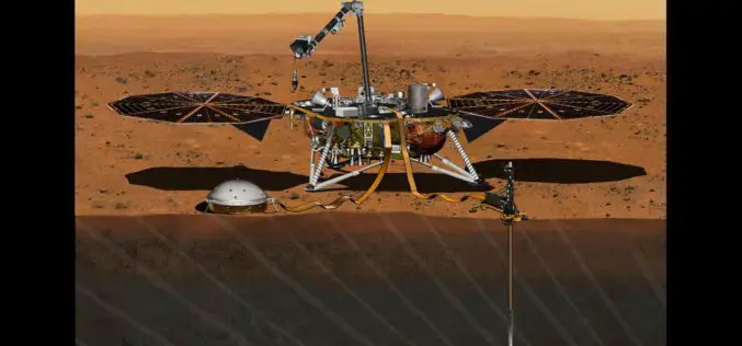
InSight Mission’s Journey to Mars Set For 2018
In December 2015, the Mars mission InSight was put on hold, but it has now been provisionally scheduled to launch to the Red Planet at the next opportunity – in
Advanced Webinar on Using NASA Remote Sensing for Flood Monitoring and Management
Advanced Webinar on Using NASA Remote Sensing for Flood Monitoring and Management When: 03/16/2016 to 04/06/2016 Times: 8:00 a.m. – 9:00 a.m. EDT (UTC-4) and 4:00 – 5:00 p.m. EDT (UTC-4)
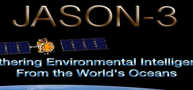
Jason-3 Successfully Launched
Vandenberg Air Force Base, California, 17 January 2016 – The Jason-3 high-precision ocean altimetry satellite was successfully launched from Vandenberg Air Force Base in California at 19:42 CET (10:42 California
Esri and NASA Collaborate to Advance Cloud Access to Imagery
Esri Opens LERC to the Geospatial Community Redlands, California—Esri and NASA are collaborating to improve access to imagery and raster data stored in the cloud using a combination of two
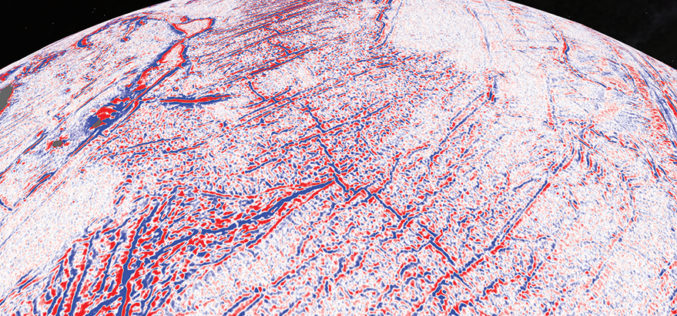
Satellite Maps Reveal Small Tectonic Plate in the Indian Ocean
A team of Australian and U.S. researchers has found a small tectonic plate or microplate in the Indian Ocean. Using Satellite maps, researchers discovered the Indian Ocean microplate, called Mammerickx Microplate and measuring
