
Tag "MGNREGA"
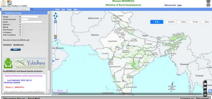
Yuktdhara – New Geospatial Planning Portal for MGNREGA
Recently the Minister of Rural Development and Panchayati Raj Giriraj Singh has launched “Yuktdhara” a new geospatial planning portal to facilitate MGNREGA assets mapping using remote sensing and geographic information
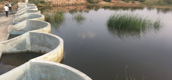
How Remote Sensing and GIS are Used to Build Check Dams Under MGNREGA?
Remote Sensing and GIS are useful to identify and choose a suitable site or probable locations for check dams. This helps to ensure best site for check dam’s construction and to prevent unscientific construction.
Maharashtra Adopted Geospatial Technology to Digitize and Decentralise MGNREGA Works
According to recent news by the DNA, the Maharashtra State Government gearing up to implement the geographic information system (GIS) to digitize and decentralize the planning, monitoring, and implementation of the
ISRO to Geo-tag Assets Created Under MGNREGA
India – According to recent news, a Memorandum of Understanding was signed between the Rural Development Ministry and ISRO, Department of Space for geo-tagging the assets created under MGNREGA in

Tribal Ministry to Use Satellite Mapping to Develop Water Bodies
The Ministry of Tribal Affairs (MoTA) is planning to use satellite mapping to identify potential water collection spots, which could be developed for fish culture and other purposes in order
