
Tag "mapping software"
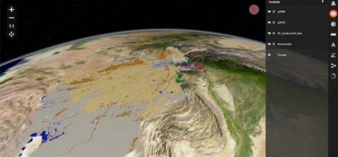
Hexagon Geospatial Releases M.App X 2020 Update 1 – Cloud-based Enterprise Solution for Imagery Intelligence
Hexagon Geospatial has recently released M.App X 2020 Update 1 with great new features. The major version of M.App X 2020 was released late in January 2020. M.App X is a
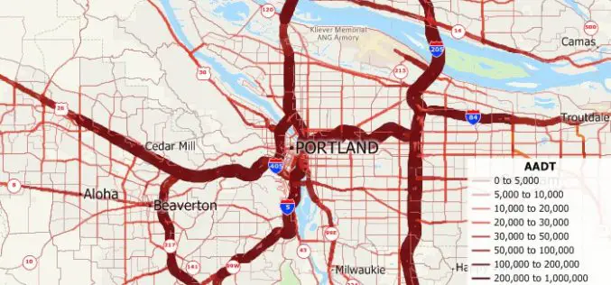
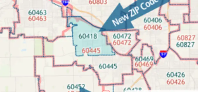
Free U.S. Traffic Count Data for Use with Maptitude 2018 Mapping Software
Newton, Massachusetts (USA) – Caliper is excited to announce the release of free USA traffic count data for Maptitude 2018 users. This latest map layer includes fields with total Annual Average Daily Traffic
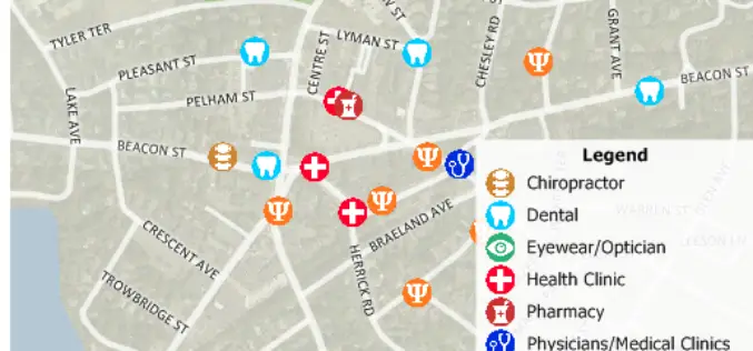
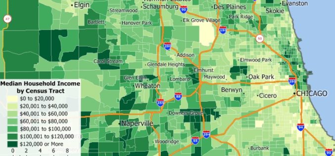
Free Healthcare Data for Use with Maptitude 2018 Mapping Software
NEWTON, MASSACHUSETTS (USA) – Caliper is excited to announce the release of free updated healthcare map layers. We are providing over 5 million medical and healthcare provider points-of-interest. These locations can
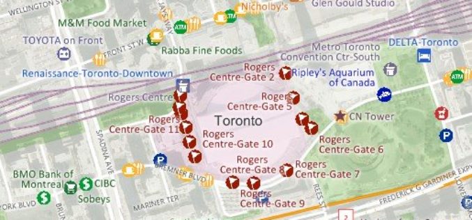
Free Point of Interest Data by Type for Use with Maptitude Mapping Software
NEWTON, MASSACHUSETTS (USA)- July 11, 2018- Free landmark point layers sorted by category are available for users of Maptitude 2018 and the United States, Australia, Canada, or United Kingdom Country Packages.
New 2018 Country Packages for the USA, Australia, Brazil, Canada, Mexico, New Zealand, and UK & Ireland
NEWTON, MASSACHUSETTS (USA) – Caliper is excited to announce the release of new 2018 Country Packages for its Maptitude mapping software. Maptitude Country Packages bring the power and flexibility of our

Maptitude Mapping Software Team Provides Corporate Sponsorship for NEGIS Spring Conference
NEWTON MA (USA) – The Northeast Geographic Information Society (NEGIS) Spring Conference was held on April 26, 2018 in Boston, Massachusetts. NEGIS is a charitable organization whose purpose is to
Four Ways Maptitude 2018 Saves You Time & Money
NEWTON MA (USA) – Business analysts need their latest data in their maps. Franchisors and retailers need to ensure that their store network is optimized to best serve their customer

Illinois Wesleyan University Selects Geospatial Corporation’s GeoUnderground and GIS-Centric Smart-Asset Management Technologies
GeoUnderground Deployed to Improve Infrastructure Capital and Business Planning Pittsburgh Pennsylvania – December 19, 2016– Geospatial Corporation (OTCQB Symbol “GSPH”), a leading innovator of asset management/analytics/mapping software and 3D mapping
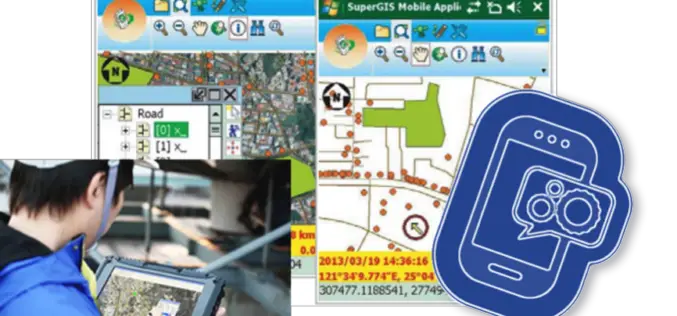
Need a Custom Windows Mobile App? Build with SuperGIS Mobile Engine!
Start make your own application on Windows Mobile Platform! Supergeo recently announced an update version of SuperGIS Mobile Engine, which greatly enhances the accessibility, the reliability and most of all,
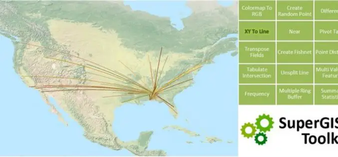
SuperGIS Toolkit 10, Driving Your GIS Tasks Powerfully!
With the popularity of spatial information and the improvements of data-collecting instruments, requirements for spatial data processing functions,across fields, are gradually increasing. In view of this, SuperGIS Desktop 10, which
