
Tag "Malta"
Business
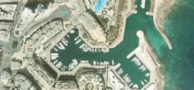
LiDAR Aerial Photo Bluesky Aerial Survey Helps Malta Develop GeoSpatial Infrastructure
July 31, 2018 – Aerial mapping company Bluesky has captured aerial photography and 3D map coverage of Malta. Working alongside tender lead IIC Technologies and Ordnance Survey, Bluesky captured ultra-high resolution
GIS
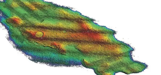
3D Map Tools Launched for Maltese Islands
According to recent news by the Times of Malta, Cloudisle – a series of baseline 3D maps of Malta that will serve as the base for research in cross-thematic fields –
