
Tag "Malaysia"

Malaysian Geospatial Master Plan to be Completed in 2018
August 22, 2017 – Putrajaya, Malaysia: The Natural Resources and Environment Ministry (NRE) is developing the National Geospatial Master Plan (NGMP) towards realising the potential of geospatial technology, in line with the
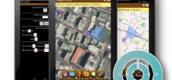
Election Commission of Malaysia Selects SuperSurv for Efficient Spatial Data Collection
Supergeo is delighted to announce that with the assistance from Supergeo’s partner in Malaysia, Suruhanjaya Pilihan Raya Malaysia (SPR Malaysia, lit. Election Commission of Malaysia) has recently chosen SuperSurv 3.3 as the
Geospatial Technology to Achieve 11th Malaysia Plan
Geospatial technology will play a crucial role in helping agencies achieve the goals set out in the 11th Malaysia Plan (RMK11), according to a panel of Malaysia’s most influential industry
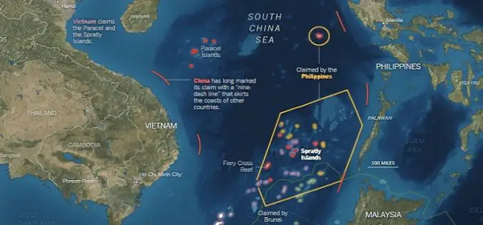
What’s Drives China in the South China Sea? A GEOINT View
Contributed By: The Spratly Islands are a group of more than 750 reefs, islets, atolls, cays and islands in the South China Sea. The history of territorial claim on these
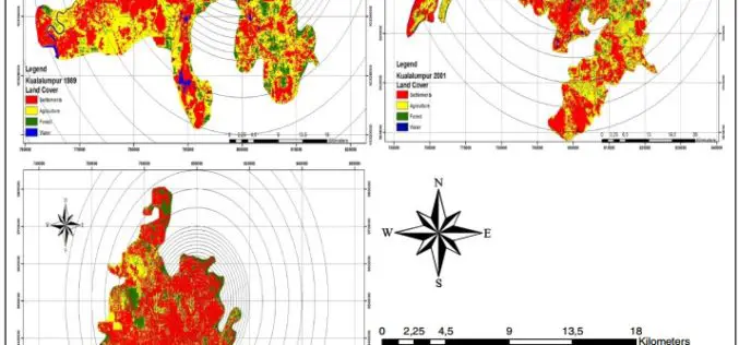
Monitoring and Modeling of Urban Growth Through Remote Sensing and GIS
Monitoring and Modeling of Urban Sprawl Through Remote Sensing and GIS in Kuala Lumpur, Malaysia – Mukesh Singh Boori, Maik Netzband , Komal Choudhary and Vít Voženílek Kuala Lumpur is
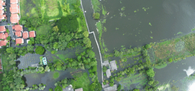
Malaysia to Use UAV to Monitor Floods
The Malaysian government will be using its newly built UAV to monitor floods during the monsoon seasons. The unmanned aircraft “Unmanned Aerial Vehicle-Remote Sensing (UV-RS)”, was collaboratively developed by ARSM, Multimedia
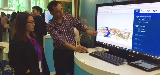
SuperSurv for iOS Selected by Kebangsaan University, Malaysia for Academics and Training
Supergeo Technologies, the global GIS software and solution provider, announces that Kebangsaan University, Malaysia selects SuperSurv for iOS for its civil engineering and environment building research and training quality. As

Malaysia is Using LiDAR to Detect and Predict Natural Disasters
In recent news by BERNAMA (Malaysian National News Agency), Malaysia is currently using a sophisticated system called ‘Light Detection and Ranging’ (LiDAR) to detect and predict natural disasters for managing disasters more efficiently
