
Tag "Leica Geosystems"
Leica Geosystems Offers New Utility Surveyor Course
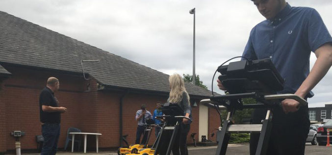
Heerbrugg, Switzerland – 20 November 2018 – Leica Geosystems, part of Hexagon, announced today the launch of a new five-day Utility Surveyor Course provided at its Detection Training Campus in Stoke-on-Trent, Staffordshire, UK. To

Leica Geosystems, GeoPal Partner to Add High Accuracy to Mobile Operations, Drive Efficiency, Productivity…
Leica Geosystems, GeoPal partner to add high accuracy to mobile operations, drive efficiency, productivity, ensure safety benefits for utility asset collection (Heerbrugg, Switzerland, 26 July 2018) – Leica Geosystems, part
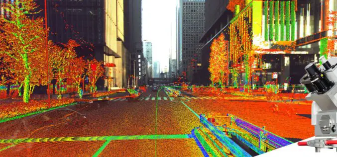
Leica Geosystems Multipurpose Mobile Mapping Platform Increases Smart City Applications
Leica Pegasus:Two Ultimate enables professional 360-degree seamless imagery Heerbrugg, Switzerland, February 06, 2018 – Leica Geosystems, industry leader of measurement technology, released today the new Leica Pegasus:Two Ultimate, an upgrade to
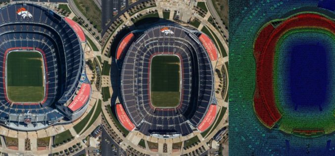
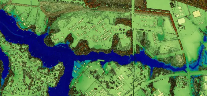
Airborne LiDAR Production Now Fully Integrated With Leica HxMap Workflow
Leica Geosystems, industry leader for reality capture and measurement technology, announced today the release of LiDAR data processing capability in the Leica RealCity solution package. Leica Geosystems partnered with international asset
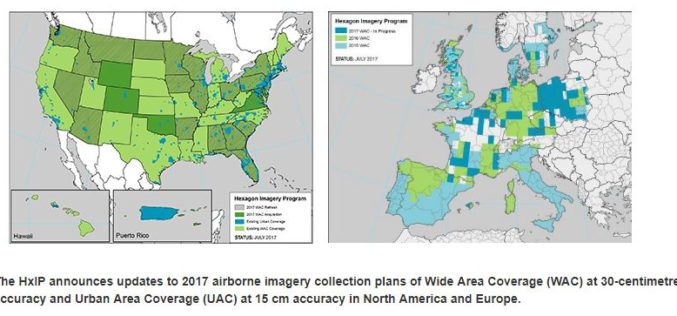
Hexagon Imagery Program Announces Updates to 2017 Airborne Imagery Collection Plans
Latest imagery collection covers U.S., Canada, Europe, plans include territories, cities (WASHINGTON, D.C., Aug. 15, 2017) – The Hexagon Imagery Program (HxIP), the premier source for professional airborne imagery provided

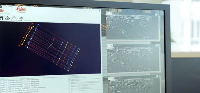
Leica Webinar: Leica Captivate Pipeline: A Transformative Approach to Pipeline Surveying
Leica Captivate Pipeline: A Transformative Approach to Pipeline Surveying Tue, Aug 8, 2017 11:00 AM – 12:00 PM PDT With more than 30,000 miles of pipeline planned and under construction
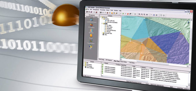
Leica Geosystems’ GNSS Networks Now Support Galileo, QZSS
(Heerbrugg, Switzerland, 16 June 2017) Leica Geosystems, industry leader in measurement technology, released Leica Spider v7.0 software suite, supporting Galileo and QZSS constellations as well as the GPS-L5 signal for

Leica Geosystems Introduces Imagery, Live Video Stream to Monitoring
Leica GeoMoS Imaging increases productivity, reduces time in the field (Heerbrugg, Switzerland, 13 June 2017) – Leica Geosystems, industry leader in measurement technology, announced today Leica GeoMoS Imaging, a monitoring
New Utility Post Processing Software Delivers CAD Drawings in Less Time with Professional Results
Leica DX Office Vision enables non-experienced CAD users to digitally map detected underground utilities (Heerbrugg, Switzerland, 14 June 2017) – Leica Geosystems, industry leader in measurement technology, released today its
New Leica SPL100 Brings up to 10x More Efficiency to Airborne LiDAR
Latest Single Photon LiDAR technology collects 6 million points per second (Heerbrugg, Switzerland, 13 February 2017) – Leica Geosystems, industry leader of reality capture and measurement technology, announced today the
