
Tag "Leica Geosystem"
Business
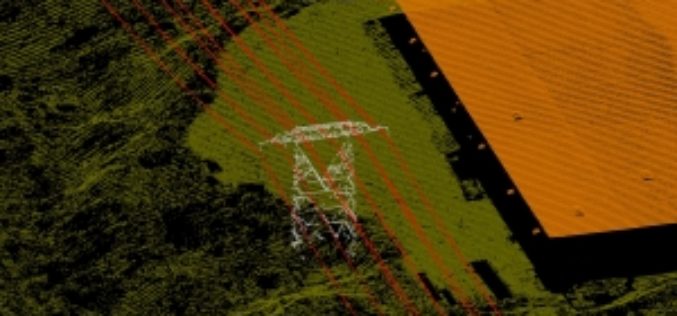
Leica Geosystems Releases ALS80 Next Generation LIDAR Mapping Solution with Market-Leading Productivity
Leica Geosystems introduces its next generation of airborne LiDAR solutions, the Leica ALS80. By incorporating advanced laser technology, new high-speed point cloud generation and viewing software, faster acquisition
Business
Software
Leica GeoMoS Adjustment v1.7: Adjusted Monitoring Network Data Available Everywhere and Quickly
Leica GeoMoS Adjustment, the network adjustment add-on for the successful Leica GeoMoS monitoring software, is intended for use in projects where the most precise and reliable information on structural movement
