
Tag "Landslides"
GIS
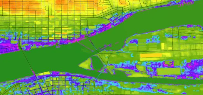
Highlight the Risk in Real Estate with Digital Elevation Model Data | cloudeo
Contributed by: Gokulakrishnan Balaji Student Marketing Munich +49 89 4141 786 23 gbalaji@cloudeo.group Location of new real estate comes with inherent uncertainties: what environmental hazards could affect this site? Before

Courses
Webinars
NASA ARSET Training: Using NASA Remote Sensing for Disaster Management
NASA ARSET Training: Using NASA Remote Sensing for Disaster Management 06/09/2016 to 06/30/2016 Times: 11:00 a.m.-12:00 p.m. and 6:00-7:00 p.m. EDT (UTC-4) NASA remote sensing and modeling resources are useful for
GIS
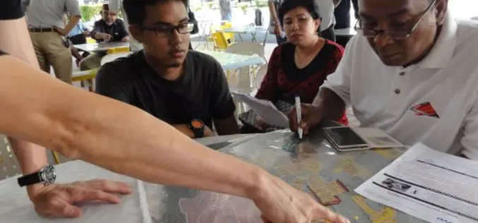
Community Mapping to Educate on Landslides
Kuala Lumpur – A local community-based organisation on landslides and slope safety, SlopeWatch embarked on a journey to educate hillside citizens on signs of slope failures to better equip them in
