
Tag "LANDSAT"
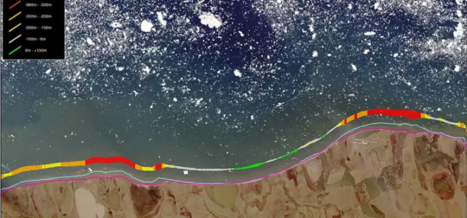
TCarta Marine Changes the Way Dynamic Environments are Managed and Monitored with Introduction of Vector Shorelines
DENVER, Colorado, USA, 8 August 2017 – TCarta Marine has made the world’s most dynamic environments easier to monitor and manage with the introduction of its new multi-scale Shoreline Products. Offered in
Sentinel Imagery Now Works Inside ArcGIS
Redlands, California—Esri enhanced its ArcGIS technology to simplify the use of free global imagery from the Sentinel-2 satellite launched by the European Space Agency. ArcGIS supports visualization, interpretation, and analysis
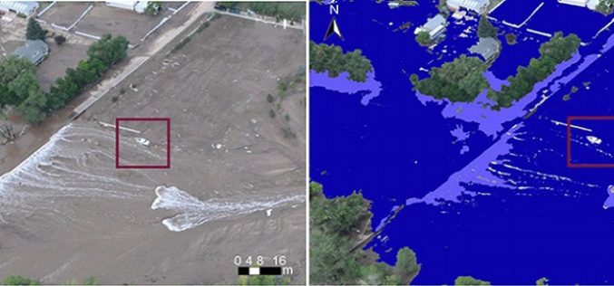
Mining Social Media to Task Satellite Data Collection During Emergencies
Combining satellite imagery with social media data enables a good match between predictions and observations in emergency situations. The era of Internet and social media has drastically changed the way
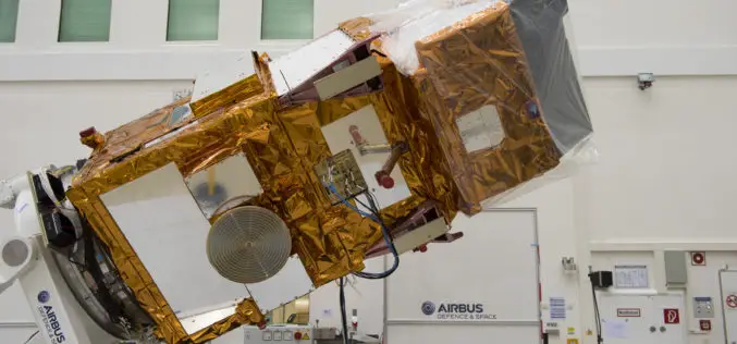
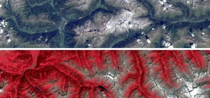
USGS Welcomes European Space Agencys New Land Observing Satellite
The U.S. Geological Survey salutes the European Space Agency (ESA) on the successful June 23 launch of its Sentinel-2A satellite, the second satellite to be launched in Europe’s Copernicus environment
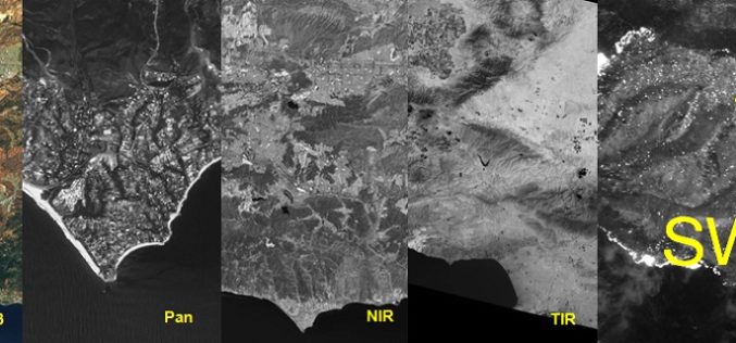
Why SWIR Band in Remote Sensing?
Each object has its own spectral signature, which is also the basic principle of remote sensing. Today we have satellites with various sensors collecting data in Visible light, Near Infrared (NIR),
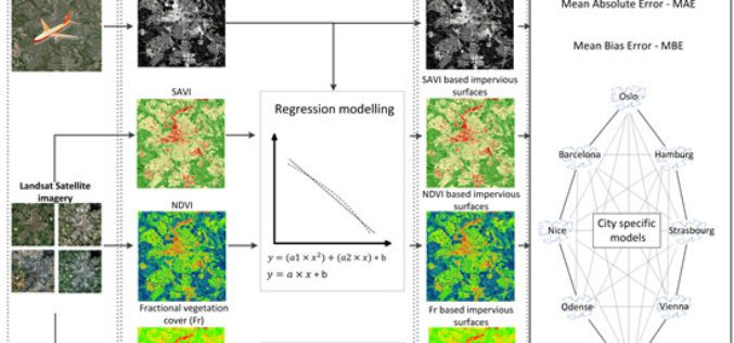
Using Landsat Vegetation Indices to Estimate Impervious Surface Fractions for European Cities
Using Landsat Vegetation Indices to Estimate Impervious Surface Fractions for European Cities – Kaspersen, P.S.; Fensholt, R.; Drews, M. Using Landsat Vegetation Indices to Estimate Impervious Surface Fractions for European Cities.
New Stable Version of GRASS GIS 7.0.0 is Released
After many years of development the new stable major release GRASS GIS 7.0.0 is available. The graphical user interface based on wxPython has been enriched with many new features in
Landsat and Water—Case Studies of the Uses and Benefits of Landsat Imagery in Water Resources
The Landsat program has been collecting and archiving moderate resolution earth imagery since 1972. The number of Landsat users and uses has increased exponentially since the enactment of a free
