
Tag "Landsat-5"

Business
Work Easier with Satellite Images – LandViewer Launches New Features
MENLO PARK, Calif. – The California-based company EOS have launched cloud based tool LandViewer, that allows non-expert users to select a geographic area for analysis, an earth observation data types,
Remote Sensing
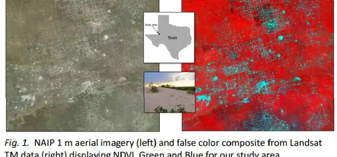
Utilizing Patch Metrics to Improve Classification of Remote Sensing Imagery
Classified remote sensing imagery is used to inform management of various natural resources, though achieving accurate results is a persistent challenge. In particular, some land cover types that are functionally

Remote Sensing
New Landsat Data Just a Few Clicks Away From ESA
Thousands of never-before-seen data products from the US Landsat satellites acquired over 30 years have been released for online access. In addition, the newest data over Europe from the latest
