
Tag "land use"

LANDSUPPORT Project Determines The Impact of Land Use
The EU funded LANDSUPPORT project officially launched on May 1st. The project partners, an international and complementary group of research centres, SMEs and policy makers, aim to develop an integrated
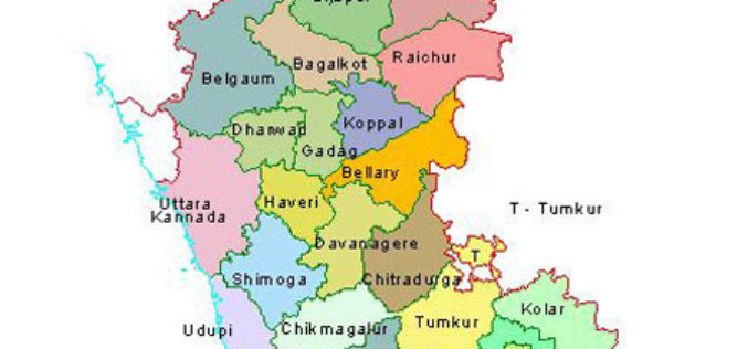
12 Taluks of Karnataka to get Soil Condition Map
According to recent news by The Hindu Business Line, the National Bureau of Soil Survey and Land Use Planning (NBSSLUP) is working on a project to map soil in 12
Sustainable Land Utilization Modeling Using GIS and Remote Sensing
According to recent news published by The Hindu, The Kerala State Land Use Board (KSLUB) is gearing up to prepare a comprehensive data bank of resources coming under the Thiruvananthapuram
UN-GGIM: Europe – Research Identifies 14 ‘Core’ INSPIRE Themes for Global Sustainable Development Goals
The scope of geospatial data extends far beyond environmental, social and economic analysis, a study by UN-GIMM: Europe has found. Research by the Regional Committee of Experts shows that information
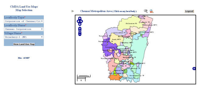
CMDA Uses GIS Based Land Use Information System for Information Dissemination
According to recent news by ToI, the Chennai Metropolitan Development Authority (CMDA) has launched a web portal to swiftly extract land-use data under the CMDA administrative area at various sites

Singapore Housing & Development Board Leverages Geospatial Technology for Land Use Planning
Since land-use planning is vital in a land-scarce Singapore, the republic’s Housing & Development Board (HDB) has leveraged Geographic Information System (GIS) technology in its Integrated Planning and Analysis system
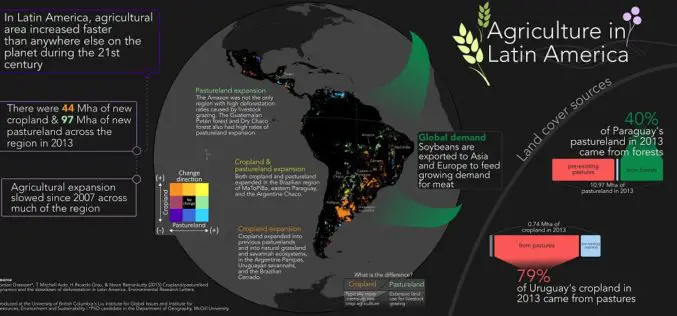
Remote Sensing to Study Dynamics of Cropland in Latin America
In a study, “Cropland/pastureland dynamics and the slowdown of deforestation in Latin America,” published in Environmental Research Letters by Jordan Graesser and et. al., brings out some interesting facts about
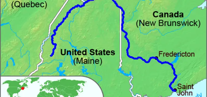
High-Precision Land-Cover-Land-Use GIS Mapping and Land Availability and Suitability Analysis for Grass Biomass Production in the Aroostook River Valley, Maine, USA
High-Precision Land-Cover-Land-Use GIS Mapping and Land Availability and Suitability Analysis for Grass Biomass Production in the Aroostook River Valley, Maine, USA – Chunzeng Wang , Jason Johnston, David Vail, Jared Dickinson and
Rwanda Launches the First-Ever Land Use Portal in Africa
Esri Eases Access to Land Information for Rwandan Citizens and Planners Redlands, California—Thanks to a new website called the National Land Use Planning Portal (NLUPP), Rwandans connected to the Internet
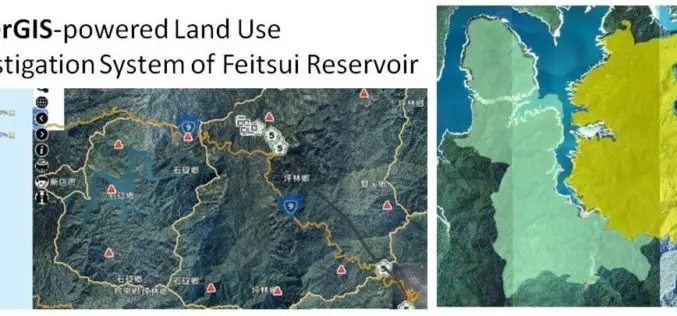
GIS Observation System Supplies Water for Lives
As the main water supply and electricity generator in great Taipei, Feitsui Reservoir is a vital resource in Taiwan. Feitsui Reservoir Administration therefore needs to ensure that water quality, water
