
Tag "KML"
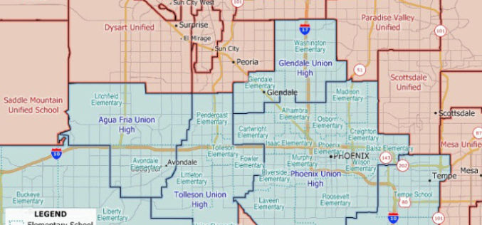
Maptitude 2020 U.S. School Districts Data Available as KML, GeoJSON, Shapefile
The Maptitude 2020 U.S. School Districts Data is available and includes three nationwide map layers of elementary, secondary, and unified school districts.

Work Easier with Satellite Images – LandViewer Launches New Features
MENLO PARK, Calif. – The California-based company EOS have launched cloud based tool LandViewer, that allows non-expert users to select a geographic area for analysis, an earth observation data types,
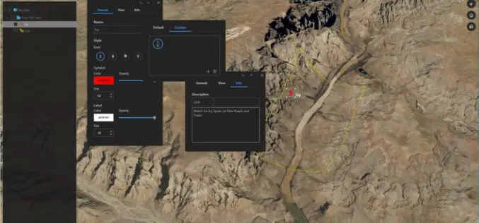
Download for Free – Esri Release ArcGIS Earth 1.4
Recently Esri 3D team has announced the release of ArcGIS Earth 1.4. ArcGIS Earth 1.4 introduces great new features that will enhance workflows for visualizing data, accessing portals, and sharing across
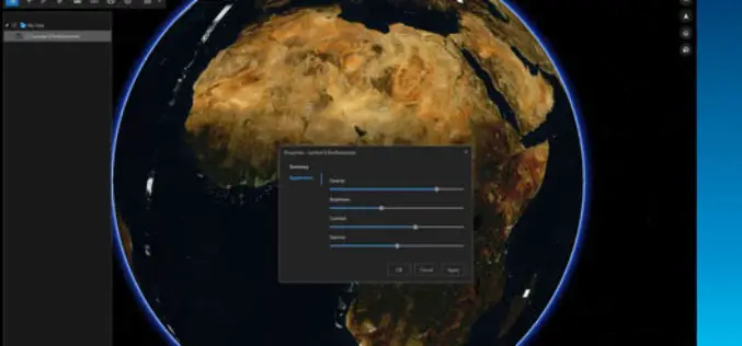
ArcGIS Earth Just Got Even Better With Launch of ArcGIS Earth 1.3
ArcGIS Earth 1.3 with Control Vertical Exaggeration and Image Properties With ArcGIS Earth 1.3 you can now do more with terrain, imagery, and KML. You will also discover authentication improvements
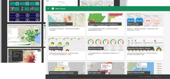
A World of Open Data
Nowadays, people are asking eagerly for Open Data and Open Government in order to gain access to unmediated facts and knowledge. Open data is, in fact, not a new idea.

OGC Adopts Updated KML Earth Browser Standard – KML 2.3
The Open Geospatial Consortium (OGC®) announces that the OGC membership has approved the OGC KML 2.3 Standard. KML is an XML grammar used to encode and transport representations of geographic
Get the Latest version 10.2.6 of the ArcGIS Runtime SDK for .NET
Esri has announced the release of latest version 10.2.6 of the ArcGIS Runtime SDK for .NET. The allows to integrate ArcGIS functionality into Windows apps for desktop and mobile. SDK also

Webinar: Smart City Solutions with Interactive 3D GIS Technologies
Smart City Solutions with Interactive 3D GIS Technologies Feeling not enough about traditional 2D maps? With SuperGIS 3D Earth Server, you can see different features and explore spatial relations on
Online Vector and Raster Converter Tool
MyGeodata Converter is an online tool that allows you to read and write from/to a huge number of CAD and GIS formats – both vector and raster. In contrast to
