
Tag "Japan"
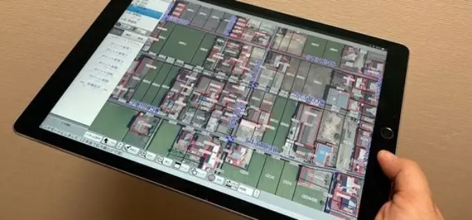
Japanese City Using GIS on iPads for Field Survey
The City of Tamba in Hyogo prefecture, Japan, performs field survey work using a mobile GIS application designed for Apple iPad tablet computers.

AIR Worldwide Expands Its Inland Flood Modeling Capabilities to Japan
Release of Touchstone Version 5.1 includes new geospatial features BOSTON, Oct. 23, 2017 — Catastrophe modeling firm AIR Worldwide has introduced a new inland flood model for Japan along with
Japan Launches Satellite Carrying Its Own Version of GPS
Japan has recently launched a rocket carrying a satellite with a local version of the US global positioning system (GPS) (Quasi-Zenith Satellite System) on Thursday (June 1, 2017), which is expected
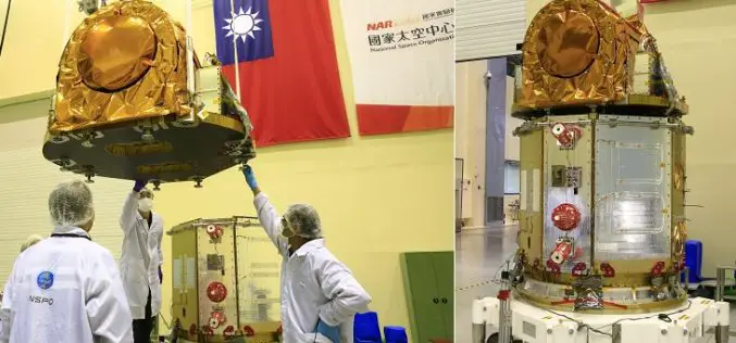
Taiwan to Use Japan’s Satellite Services Until FORMOSAT-5 is Launched
According to recent news by the Taipai Times, Taiwan would seek to use Japan’s satellite services until its newest satellite, the FORMOSAT-5, can be launched later this year. Minister of

Vricon and Japan Space Imaging Partner on Bringing High-res 3D and Elevation Geodata Products to Japan
McLean, VA – 6 April 2016 —Vricon has announced it has selected Japan Space Imaging Corporation (JSI) for an exclusive reselling agreement. JSI is appointed as Vricon’s distributor in Japan
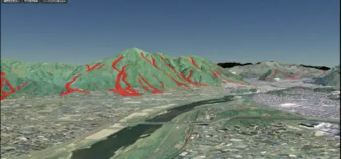
Geospatial Information Authority of Japan Released a Free Online 3D Mapping Service
A national surveying institute has released a free online 3D mapping service that could help increase natural disaster preparedness by showing accurate renditions and contours of landforms. Created by the
Japan Govt Eyes High-precision Hyperspectral Sensor to Detect Resources
The Government of Japan is planning to conduct a feasibility test for a high-precision sensor capable of detecting oil, rare earths and other mineral resources from the International Space Station
