
Tag "Indonesia"

Indonesian Peat Prize Announces 1 Million US Dollar Competition Winner
Indonesian Peat Prize Announces 1 Million US Dollar Competition Winner: International Peat Mapping Team: Remote Sensing Solutions GmbH (RSS), Agency for Assessment and Application of Technology (BPPT), and Sriwijaya University

Taiwan and Indonesia Signed Pact on Cooperation in Geodesy and Geomatics
According to recent news reported by the Taiwan News, Taiwan and Indonesia have signed a pact on Dec. 20 to foster cooperation in geodesy and geomatics, the scientific fields concerned with

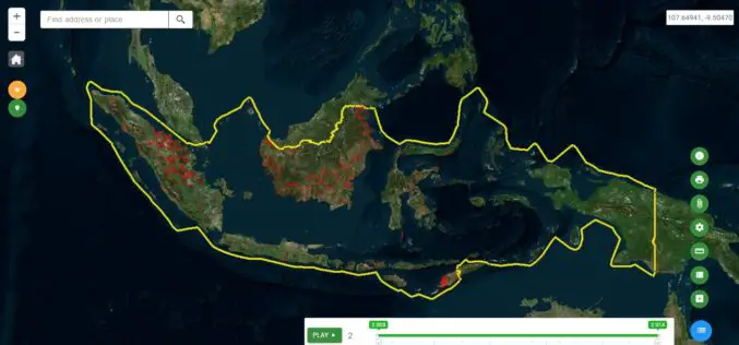
Ministry of Public Works of Indonesia Selects SuperSurv
With the assistance of Supergeo’s reseller in Indonesia- GPS Lands Indosolutions, the Ministry of Public Works and Housing (Kementerian PUPR) of Indonesia has selected SuperSurv for their tasks of spatial
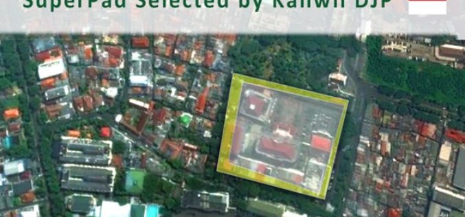
Taxation Authority in Indonesia Selects SuperPad 3.3 to Collect Data
With the assistance of Supergeo’s partner in Indonesia, DataScrip, the regional offices of Indonesian taxation authority recently selected SuperPad 3.3 as the mobile GIS software for spatial data collection. Under
Indonesia Launches Geospatial Portal for Forest Monitoring and Protection
Indonesia – According to recent news by the Eco-Business, the Ministry of Environment and Forestry has launched a new geospatial portal, which will serve as the dedicated and reliable source
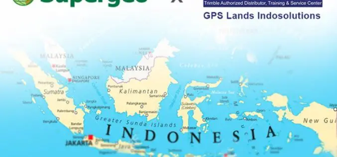
Supergeo Announces Partnership with GPS Lands Indosolutions in Indonesia
Supergeo Technologies Inc., the global GIS software and solution provider, announces the partnership with PT. GPS Lands Indosolutions in Indonesia. Headquartered in Jakarta, PT. GPS Lands Indosolutions is a company
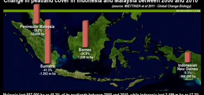
Jakarta Adopted LiDAR To Map and Protect Peatland Forests
According to recent news by The Jakarta Post, the Government of Indonesia has started producing a detailed peatland map using light detection and ranging (LiDAR) technology to better manage the nation’s

Indonesia Using Geoportal to Monitor the Condition of Public Infrastructure
The Ministry of Public Works and Public Housing’s Institute of Road Engineering, Agency for Research and Development (Pusjatan) has unveiled a new smart mapping portal called Geoportal Pusjatan, which was
Indonesian Gears Up Smart City Roadmap with Smart Mapping Technology
The City of Depok, located in the West Java Province, Indonesia, has cemented its commitment to achieve smart city status by 2025 by leveraging state-of-the-art mapping technology to boost government
Indonesia Geospatial Information Agency to Survey 3,000 Islands
In recent news by ANTARA News, Geospatial Information Agency of Jakarta will be verifying about 3,000 unnamed islands in Indonesia and put their coordinate on the map. Indonesia is an
